

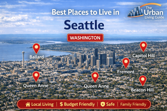
Best Neighborhoods in Seattle, Washington: Emerald City Living, Puget Sound Enclaves & Urban Hubs in 2026
Covering approximately 83.8 square miles of land area across the narrow isthmus between the saltwater bays of Puget Sound and the freshwater expanse of Lake Washington in King County, the City of Seattle functions under the mayor-council governance of the City of Seattle. Housing an incorporated municipal core population exceeding 750,000 residents and anchoring a massive Pacific Northwest metropolitan area of over 4.05 million people, the “Emerald City” stands as a premier global headquarters for cloud computing, aerospace logistics, biotechnology, and maritime trade.
Relocating across Seattle requires evaluating steep hill topography, maritime weather patterns, microclimate shifts, and multi-modal transit corridors managed by Sound Transit and King County Metro. Inbound movers consistently balance direct access to primary regional employers—including the corporate headquarters of Amazon in South Lake Union, Microsoft Campus in Redmond, the Fred Hutchinson Cancer Center, and aviation networks at Seattle-Tacoma International Airport (SEA)—against daily commute routes across Interstate 5, State Route 99 (SR-99 Tunnel), State Route 520 (Evergreen Point Floating Bridge), and Interstate 90.
Take a virtual walking tour through the tree-lined streets, canal bridges, and distinctive residential neighborhoods of Seattle, Washington:
Key Residential Districts Across Seattle, Washington in 2026
| Neighborhood Name | Location | Distance from Core (Downtown Seattle) | Development Status | Transit Connectivity | Cost Level | Best Fit For |
|---|---|---|---|---|---|---|
| Capitol Hill | East Central Ridge | Approximately 1 mile east | High-Density Urban Arts Core | Exceptional (1 Line Light Rail, First Hill Streetcar) | High-to-Premium | Young Professionals, Tech Workers & Creatives |
| Ballard | Northwest Coastal Basin | Approximately 5 miles northwest | Historic Maritime & Modern Infill | High (RapidRide D Line, 15th Ave NW) | Mid-to-High Range | Families, Boaters & Culinary Enthusiasts |
| Queen Anne | North Central Hilltop | Approximately 2 miles north | Historic Hilltop & Modern Lower Core | High (King County Metro Buses, SR-99) | Ultra-Premium | Corporate Executives, Luxury Buyers & Doctors |
| Fremont | North Lake Union Canal | Approximately 3.5 miles north | Eclectic Commercial & Tech Waterfront | High (Burke-Gilman Trail, Aurora Ave / SR-99) | Mid-to-High Range | Tech Employees, Cyclists & Remote Professionals |
| Beacon Hill | South Central Ridge | Approximately 3 miles south | Diverse Residential & Transit-Oriented | Exceptional (1 Line Subterranean Light Rail, I-5) | Accessible / Mid-Range | Budget-Conscious Buyers, Commuters & Families |
Comprehensive Breakdown of the Best Neighborhoods in Seattle, Washington
Capitol Hill — Dynamic Arts Nexus, Culinary Strip & Light Rail Transit
Stretching along the ridge directly east of Downtown Seattle and South Lake Union, Capitol Hill is widely celebrated as the city’s cultural, nightlife, artistic, and social epicenter. Operating under City of Seattle municipal administration and supported by the Capitol Hill Broadway Business Improvement District, the district blends historic turn-of-the-century brick mansions along Millionaire’s Row with dense mid-rise apartment communities along Broadway and Pike/Pine Corridor.
The neighborhood is renowned for independent coffee roasters, live music venues, LGBTQ+ cultural heritage, and world-class dining, providing a true 24/7 walkable lifestyle with direct light rail transit to the airport and the University of Washington.
- Housing: Architectural inventory features converted brick vintage courtyard apartments, modern podium mid-rises, sleek condominium towers, and grand historic mansions near Volunteer Park. Condominium purchase valuations typically range from $420,000 to $1,450,000+, while modern 1-bedroom apartment rentals average $1,950 to $3,200 per month.
- Safety & Crime Rate: Patrolled by the Seattle Police Department (SPD) East Precinct. Pedestrian corridors along Broadway and Pike Street maintain constant foot traffic, though opportunistic vehicle break-ins and property larceny occur around busy commercial nightlife corridors.
- School District & Education Quality: Governed by Seattle Public Schools (SPS), containing neighborhood options such as Lowell Elementary School and Meany Middle School, alongside higher-education anchors including Seattle University and Seattle Central College.
- Walkability & Daily Conveniences: Outstanding pedestrian infrastructure (Walk Score of 95-98/100). Residents walk to grocery markets including QFC on Broadway, Trader Joe’s on E Madison, H Mart, independent bookshops, and dozens of award-winning restaurants and bakeries.
- Parks & Green Spaces / Pet-Friendliness: Exceptional urban parklands anchored by the 48-acre Volunteer Park (featuring the historic Volunteer Park Conservatory, Seattle Asian Art Museum, and water reservoirs), Cal Anderson Park (featuring lighted athletic turf, reflecting pools, and dog runs), and Interlaken Park. Highly pet-friendly.
- Parking & Traffic Congestion: Street parking is strictly regulated with city Restricted Parking Zone (RPZ) permits; off-street garage parking adds $200 to $350 per month. Surface traffic slows along Olive Way and E John Street during evening commute hours.
- Noise Levels & Vibe: Energetic, progressive, and high-tempo, filled with live acoustic music, outdoor patio conversations, and bustling weekend brunch crowds.
- Medical Facilities & Hospitals: Direct medical access anchored on First Hill by Swedish Medical Center – First Hill Campus, Virginia Mason Medical Center, and Harborview Medical Center.
- Transit Connectivity: Unmatched regional transit access via the subterranean Capitol Hill 1 Line Light Rail Station, providing a 4-minute train ride to Downtown Seattle and 35 minutes to Sea-Tac Airport, supplemented by the First Hill Streetcar and King County Metro bus routes.
- Affordability: High-tier urban pricing profile; elevated rents per square foot reflect the neighborhood’s unmatched transit convenience, arts scene, and tech employer proximity.
- Who It’s Best For: Young tech workers, healthcare fellows, university students, creative professionals, and urbanites seeking an energetic, car-optional lifestyle.
- Drawbacks: Weekend evening street noise near Pike/Pine entertainment hubs, limited street parking for guests, and higher price-per-square-foot rental rates.
Ballard — Historic Nordic Roots, Craft Brewery Hub & Puget Sound Shoreline
Situated in northwestern Seattle along the tidal waters of Salmon Bay and Shilshole Bay, Ballard is an established neighborhood combining historic maritime roots with modern residential infill. Once an independent town settled by Scandinavian fishermen, Ballard operates under City of Seattle municipal oversight and is championed by the Ballard Alliance. The district centers along the historic brick storefronts of Ballard Avenue NW and NW Market Street.
The neighborhood is celebrated for its bustling year-round Sunday farmers market, destination craft breweries in the Ballard Brewery District, and family-friendly community atmosphere.
- Housing: Real estate stock features classic 1920s Craftsman bungalows, modern multi-story contemporary townhomes, and luxury mid-rise apartment communities. Single-family purchase prices typically range from $750,000 to $1,650,000+, while modern townhomes and apartments average $1,850 to $3,100 per month.
- Safety & Crime Rate: Patrolled by the SPD North Precinct. Residential neighborhoods north of 65th Street maintain low crime rates and high stability, while commercial strips along Market Street experience typical property and vehicle incidents.
- School District & Education Quality: Governed by Seattle Public Schools, containing top-performing public institutions such as Ballard High School (renowned for its biotechnology and digital filmmaking academies), Whitman Middle School, and Adams Elementary School.
- Walkability & Daily Conveniences: Outstanding pedestrian walkability (Walk Score of 88-92/100 around the core). Residents walk to boutique retail, seafood bistros, bakeries, and major supermarkets including PCC Community Markets, Trader Joe’s, and Ballard Market.
- Parks & Green Spaces / Pet-Friendliness: Exceptional natural amenities anchored by the historic Hiram M. Chittenden Locks (Ballard Locks) and botanical garden, the sandy beaches and Olympic Mountain sunset views at Golden Gardens Park, and Salmon Bay Park. Exceptionally pet-friendly.
- Parking & Traffic Congestion: Residential street parking is manageable north of 65th Street, while central townhome blocks rely on assigned driveway pads. Commuter traffic builds along 15th Avenue NW and across the Ballard Bridge during morning rush hours.
- Noise Levels & Vibe: Nautical, relaxed, and community-centered, shifting from lively taproom patios to serene residential tree-lined streets in north Ballard.
- Medical Facilities & Hospitals: Direct emergency medical coverage provided within the district by Swedish Medical Center – Ballard Campus on NW Tallman Avenue.
- Transit Connectivity: High-frequency public transit provided by the King County Metro RapidRide D Line running down 15th Ave NW directly into Downtown Seattle, with road links via 15th Ave NW and Leary Way NW.
- Affordability: Mid-to-high price tier; offers strong single-family home value and modern townhome options relative to Queen Anne and Capitol Hill.
- Who It’s Best For: Families seeking strong public high school clusters, boating and maritime enthusiasts, craft brewery fans, and tech workers wanting coastal charm.
- Drawbacks: Commuter traffic slowdowns when the Ballard Bridge opens for marine traffic, lack of direct light rail train stops (currently reliant on rapid buses), and rising housing purchase prices.
Queen Anne — Iconic Hilltop Skyline Views, Historic Mansions & Uptown Culture
Rising prominently north of Downtown Seattle between Elliott Bay and Lake Union, Queen Anne is one of the city’s most historically prestigious, architecturally distinguished, and picturesque neighborhoods. Crowned by Upper Queen Anne‘s tree-lined avenues and historic Queen Anne-style mansions, and anchored at the base by the cultural hub of Lower Queen Anne (Uptown), the community operates under City of Seattle governance and the Queen Anne Historical Society.
The neighborhood is world-famous for postcard views of the Seattle skyline, Space Needle, and Mount Rainier from Kerry Park, offering a tranquil residential haven just minutes from downtown employment towers.
- Housing: Real estate stock is composed of multi-million dollar historic brick Georgian and Victorian mansions, 1920s Tudor Revival residences, modern luxury townhomes, and view condominiums along Queen Anne Avenue N and Highland Drive. Single-family purchase prices typically range from $950,000 to $4,800,000+, while rental apartments average $2,100 to $3,900 per month.
- Safety & Crime Rate: Patrolled by the SPD West Precinct. Upper Queen Anne consistently posts some of the lowest violent and property crime figures in Seattle, supported by high residential stability and active neighborhood block watches.
- School District & Education Quality: Governed by SPS, featuring highly rated public campuses such as Queen Anne Elementary, McClure Middle School, and nearby secondary schools, alongside higher-education campuses anchored by Seattle Pacific University (SPU) on the north slope.
- Walkability & Daily Conveniences: The central hilltop retail village along Queen Anne Avenue N is highly walkable, hosting independent coffee houses, boutique clothing shops, bakeries, and grocers like Trader Joe’s, Safeway, and Ken’s Market, while Lower Queen Anne offers dense retail and dining.
- Parks & Green Spaces / Pet-Friendliness: World-class municipal parks including Kerry Park, Marshall Park, Parsons Gardens, Kinnear Park (featuring off-leash dog paths), and direct access to cultural events at the 74-acre Seattle Center (home to the Space Needle, Climate Pledge Arena, and Pacific Northwest Ballet). Exceptionally dog-friendly.
- Parking & Traffic Congestion: Private multi-car garages and residential driveways are standard in Upper Queen Anne. Traffic slows on steep hill access routes like Queen Anne Counterbalance (Queen Anne Ave N) during winter ice and evening rush hours.
- Noise Levels & Vibe: Serene, refined, and polished in Upper Queen Anne, with energetic sports and theater crowds focused around Climate Pledge Arena in Uptown.
- Medical Facilities & Hospitals: Direct 8-minute commute to the world-renowned research campus at Fred Hutchinson Cancer Center in South Lake Union and Swedish Medical Center.
- Transit Connectivity: Road travel connects quickly via Aurora Avenue N (SR-99) and Mercer Street, supported by King County Metro Bus Routes (Routes 2, 3, 4, and 13) and the Seattle Center Monorail connecting Uptown to Westlake Center.
- Affordability: Ultra-premium price structure; elevated real estate acquisition costs reflect premier panoramic water views, safety, and historic architectural appeal.
- Who It’s Best For: Corporate executives, tech leaders at Amazon and Google, healthcare directors, and buyers seeking elite hilltop tranquility and panoramic Puget Sound vistas.
- Drawbacks: High housing costs, steep hill topography challenging for casual cycling, and event traffic congestion in Lower Queen Anne on concert and game days.
Fremont — “Center of the Universe,” Tech Campuses & Quirky Canal Living
Situated along the northern banks of the Lake Washington Ship Canal and Lake Union, Fremont proudly bills itself as the self-proclaimed “Center of the Universe.” Celebrated for its counterculture arts heritage, public outdoor sculptures (including the famous 18-foot stone Fremont Troll under the Aurora Bridge and the Lenin Statue), and lively community parades, Fremont operates under City of Seattle municipal guidelines.
The neighborhood has evolved into a major technology center, hosting corporate waterfront engineering offices for Google, Adobe, and Tableau alongside independent craft chocolatiers and canal bistros.
- Housing: Real estate features contemporary multi-story townhomes, converted historic Craftsman cottages, and modern mixed-use mid-rise apartment complexes along N 34th Street and Fremont Avenue N. Single-family and townhome purchase prices typically range from $680,000 to $1,350,000, while rental apartments average $1,750 to $2,950 per month.
- Safety & Crime Rate: Patrolled by the SPD North Precinct. The neighborhood maintains safe pedestrian streets and strong community engagement, though standard city awareness regarding vehicle break-ins is advised near commercial parking lots.
- School District & Education Quality: Governed by SPS, zoned to public options including B.F. Day Elementary School (the longest continuously operating public elementary school in Seattle, established in 1892) and Hamilton International Middle School.
- Walkability & Daily Conveniences: Outstanding pedestrian accessibility (Walk Score of 90-94/100). Residents walk to artisan bakeries, coffee roasters, craft cider houses, the famous Theo Chocolate Factory, and the weekly open-air Fremont Sunday Market.
- Parks & Green Spaces / Pet-Friendliness: Exceptional waterfront recreation anchored by the 20-acre Gas Works Park on Lake Union (featuring kite-flying hills, industrial remnants, and panoramic Seattle skyline views), Fremont Canal Park, and direct connectivity to the 27-mile paved multi-use Burke-Gilman Trail. Exceptionally pet-friendly.
- Parking & Traffic Congestion: Assigned garage parking is typical in townhomes and apartments, while street parking is competitive near the commercial core. Commuter traffic builds along Fremont Avenue N and across the historic blue-and-orange Fremont Bridge (one of the most active drawbridges in the nation).
- Noise Levels & Vibe: Quirky, artistic, and energetic, filled with tech professionals, trail cyclists, outdoor diners, and festival crowds during the Fremont Solstice Parade.
- Medical Facilities & Hospitals: Direct 7-minute drive to UW Medical Center – Montlake and Swedish Medical Center – Ballard Campus.
- Transit Connectivity: Direct cycling access along the Burke-Gilman Trail directly into South Lake Union and the University of Washington, supported by King County Metro Bus Routes (Routes 31, 32, 40, and 62) and vehicle access to State Route 99 (Aurora Ave N).
- Affordability: Balanced mid-to-high urban price tier; delivers strong modern townhome value, tech campus proximity, and canal lifestyle amenities.
- Who It’s Best For: Tech professionals working at Google or Adobe in Fremont, Amazon commuters, avid cyclists using the Burke-Gilman Trail, and creatives who appreciate public art.
- Drawbacks: Commuter bottlenecks during frequent Fremont Bridge drawbridge openings, limited detached single-family home inventory, and weekend tourist crowds.
Beacon Hill — Light Rail Connectivity, Cultural Diversity & Panoramic Mountain Vistas
Covering a prominent geographic ridge southeast of Downtown Seattle between Interstate 5 and Rainier Valley, Beacon Hill (comprising North, Mid, and South Beacon Hill) is celebrated as one of Seattle’s most culturally diverse, scenic, and transit-connected neighborhoods. Centered along Beacon Avenue S, the community operates under City of Seattle municipal administration.
Known for panoramic skyline views of downtown and Mount Rainier, community food forests, authentic international dining, and direct light rail transit, Beacon Hill delivers practical urban living with strong neighborhood roots.
- Housing: Real estate consists of mid-century single-story box and ranch homes, historic 1920s Craftsman bungalows, modern transit-oriented apartment mid-rises near the light rail station, and contemporary townhomes. Single-family purchase prices typically range from $540,000 to $920,000, while rental apartments and flats average $1,450 to $2,350 per month.
- Safety & Crime Rate: Patrolled by the SPD South Precinct. Residential tracts in North and Mid-Beacon Hill maintain safe, community-oriented streets with active block associations, while commercial corridors near highway ramps experience typical urban property crimes.
- School District & Education Quality: Governed by SPS, containing neighborhood campuses such as Beacon Hill International School (celebrated for its Spanish and Mandarin dual-language immersion programs), Mercer International Middle School, and Franklin High School.
- Walkability & Daily Conveniences: High pedestrian accessibility around the North Beacon Hill Light Rail Station hub, hosting independent cafes, international bakeries, Vietnamese noodle shops, local markets, and grocers like Red Apple Market.
- Parks & Green Spaces / Pet-Friendliness: Outstanding recreational amenities anchored by Jefferson Park (a 52-acre park featuring a public 18-hole golf course, driving ranges, tennis complexes, skate parks, and lawn bowling), the Beacon Food Forest (the nation’s largest public foraging garden), and Daejeon Park. Exceptionally pet-friendly.
- Parks & Green Spaces / Pet-Friendliness: Plentiful private residential driveways and open on-street parking compared to north Seattle districts. Highway on-ramps provide fast access to Interstate 5 (Exits 163/164) and Interstate 90 with minimal local delay.
- Noise Levels & Vibe: Grounded, multicultural, and community-centered, shifting from lively commercial transit plazas to quiet, bird-filled residential streets.
- Medical Facilities & Hospitals: Direct medical infrastructure supported by the VA Puget Sound Health Care System (Seattle VA Medical Center) on Columbian Way and 8-minute access to Harborview Medical Center downtown.
- Transit Connectivity: Outstanding heavy rail transit centered at the Beacon Hill 1 Line Light Rail Subterranean Station, offering a 6-minute direct train ride to Downtown Seattle and 25 minutes to Sea-Tac Airport, alongside rapid highway access to I-5.
- Affordability: Seattle’s most accessible central homeownership and rental price tier, offering substantial single-family lots, panoramic views, and light rail access at attainable price points.
- Who It’s Best For: First-time homebuyers, tech and healthcare commuters needing light rail access, international culinary enthusiasts, and families seeking dual-language immersion schooling.
- Drawbacks: Airplane noise on select southern flight descent paths heading toward Sea-Tac, ongoing urban infill transitions, and fewer upscale boutique retail power centers.
Neighborhood Trade-offs: Living Advantages & Drawbacks Across Seattle, Washington
| Neighborhood | Core Advantages (Pros) | Core Limitations (Cons) |
|---|---|---|
| Capitol Hill | Direct 1 Line Light Rail station; high walkability to dining, cafes, and arts; 48-acre Volunteer Park; vibrant nightlife scene. | Higher rent and condominium purchase prices; monthly garage parking fees ($200+); weekend late-night noise along Pike/Pine. |
| Ballard | Historic maritime charm on Ballard Ave; top-rated Ballard High school; Golden Gardens Beach; Ballard Brewery District. | Commuter bottlenecks during Ballard Bridge drawbridge openings; lack of direct light rail train stops; rising home costs. |
| Queen Anne | Iconic skyline and Mount Rainier views at Kerry Park; prestigious historic mansions; top-tier safety; close to Seattle Center. | Ultra-premium real estate valuations; steep hill grades challenging for walking/biking; Climate Pledge Arena event traffic. |
| Fremont | Major tech hub (Google, Adobe); direct access to 27-mile Burke-Gilman Trail and Gas Works Park; quirky arts and dining culture. | Traffic delays during Fremont Bridge marine openings; limited detached single-family home inventory; weekend tourist crowds. |
| Beacon Hill | Seattle’s most accessible central housing prices; direct 1 Line Light Rail access to downtown/airport; 52-acre Jefferson Park. | Aviation noise on southern flight paths; developing commercial corridors; fewer high-end luxury retail centers. |
Finding Your Ideal Fit Among Seattle, Washington Neighborhoods
Selecting your ideal neighborhood in Seattle requires balancing your gross household budget with daily workplace destinations, family schooling preferences, and transit logistics. Because the Seattle metropolitan area is geographically constrained by Puget Sound and Lake Washington, your chosen location dictates whether your daily commute relies on rapid transit via the Sound Transit 1 Line Light Rail (Capitol Hill, Beacon Hill, University District), dedicated bike routes along the Burke-Gilman Trail (Fremont, Ballard), or highway passage across bridges like SR-520 and I-90.
Tech workers in South Lake Union, software engineers in Fremont, corporate professionals in Downtown Seattle, and healthcare researchers on First Hill should evaluate transit routes to minimize peak-hour bridge and highway congestion.
Beyond commuter corridors, evaluate essential municipal utility and building infrastructure realities. The Pacific Northwest experiences extended overcast and rainy winter weather with mild marine temperatures, making energy efficiency, moisture ventilation, and utility reliability through Seattle City Light—the nation’s first municipal utility to become carbon-neutral—and Puget Sound Energy (PSE) an important factor.
In addition, prospective homebuyers evaluating historic Craftsman homes in Ballard or Queen Anne should budget for roof and drainage maintenance, while townhome buyers in Fremont should verify homeowners association (HOA) maintenance schedules. Before executing a residential lease or property purchase, verify high-speed fiber broadband availability (such as CenturyLink Fiber, Astound Broadband, or Xfinity Gigabit) and confirm Seattle Public Schools assignment boundaries.
Essential FAQs About Living in Seattle, Washington Neighborhoods
Which neighborhood in Seattle is considered best for families with school-age children?
Ballard and Queen Anne are widely regarded as premier family communities in Seattle. Ballard offers access to top-performing public schools like Ballard High School alongside safe, tree-lined residential streets and beach parks at Golden Gardens. Queen Anne provides historic hilltop neighborhoods, low crime rates, and proximity to Queen Anne Elementary and Seattle Center cultural institutions.
What is the most walkable neighborhood in Seattle where you can live without a car?
Capitol Hill and Fremont offer the highest walkability in Seattle, both scoring above 90 on Walk Score. Capitol Hill allows residents to complete all daily errands on foot, walk to multiple grocery stores like QFC and Trader Joe’s, access hundreds of restaurants, and connect to the subterranean 1 Line Light Rail Station. Fremont provides dense pedestrian and cycling access along the Burke-Gilman Trail directly into tech campuses.
What are the safest residential neighborhoods to live in within Seattle?
Queen Anne and Ballard consistently report some of the lowest violent and property crime rates in the city. Upper Queen Anne benefits from isolated hilltop geography and active community block watches, while northern Ballard residential enclaves maintain high stability and dedicated police patrols.
What are the most affordable neighborhoods for homebuyers and renters in Seattle?
Beacon Hill and surrounding South Seattle neighborhoods (such as Columbia City and Rainier Beach) provide the most budget-friendly housing opportunities in the city. In Beacon Hill, buyers and renters can secure single-family homes and modern townhomes with direct light rail access at price points substantially lower than north Seattle enclaves.
How bad is traffic congestion when commuting across Seattle bridges?
Traffic congestion on Seattle bridges—particularly the Ballard Bridge, Fremont Bridge, and floating bridges across Lake Washington (SR-520 and I-90)—is significant during morning and evening rush hours. Marine bridge openings on the Lake Washington Ship Canal can add 10 to 20 minutes to local driving commutes.
Which Seattle neighborhood is best for tech professionals working in South Lake Union or Fremont?
Capitol Hill, Fremont, and Queen Anne provide the fastest commutes to major technology campuses. Fremont hosts Google and Tableau offices directly within the neighborhood, while Capitol Hill and Lower Queen Anne are within a 5-to-15 minute walk, bike ride, or bus trip to Amazon’s South Lake Union headquarters.
How does rainy winter weather impact living in Seattle neighborhoods?
Seattle experiences frequent overcast skies and light drizzle from October through April, but heavy downpours and sub-freezing snowstorms are relatively rare compared to Midwestern or East Coast cities. Selecting a neighborhood with high walkability, dense indoor amenities, and good public transit helps maintain an active lifestyle year-round.
Seattle, Washington Relocation Resources & Living Guides
The Urban Living Guide creates deeply researched, practical, and informative city relocation resources designed to help individuals, working professionals, and families navigate complex urban landscapes. By analyzing municipal infrastructure, hyper-local zoning patterns, commuter realities, and housing markets, our guides provide actionable insights so you can make confident, data-backed decisions when moving to major metropolitan areas.
Explore our comprehensive guides to the Seattle metropolitan region:
- Living in Seattle, Washington
- Cost of Living in Seattle, Washington
- Pros and Cons of Living in Seattle, Washington
Made your decision to move to the Emerald City? Read our comprehensive relocation roadmap: Moving to Seattle, Washington.
Follow The Urban Living Guide for ongoing regional insights, neighborhood developments, and expert local coverage across Greater Seattle and the state of Washington.