

Best Neighborhoods in Pittsburgh: Three Rivers Enclaves, Historic Ridges & Tech Corridors in 2026
Covering approximately 58.3 square miles of land area nestled within the steep river valleys and plateau ridges where the Allegheny and Monongahela Rivers form the Ohio River, the City of Pittsburgh operates under the mayor-council municipal administration of the City of Pittsburgh while anchoring Allegheny County. Housing an incorporated municipal core population exceeding 302,000 residents and serving a broader metropolitan footprint of over 2.37 million people, the “Steel City” has successfully transformed from an industrial manufacturing capital into an internationally recognized hub for robotics, artificial intelligence, biotechnology, and academic healthcare.
Relocating across Western Pennsylvania requires evaluating dramatic hill topography, historic bridge crossings, four-season climate shifts, and multi-modal transit networks operated by Pittsburgh Regional Transit (PRT). Inbound movers consistently balance direct access to primary regional employers—such as the Downtown Golden Triangle Financial Center, the dense academic and medical research corridor in Oakland, robotics firms in the Bakery Square and Strip District Tech Hubs, and extensive hospital systems anchored by UPMC (University of Pittsburgh Medical Center) and Allegheny Health Network (AHN)—against daily commute routes across Interstate 376 (Penn-Lincoln Parkway), Interstate 279, Route 28, the Fort Pitt and Liberty Tunnels, and the iconic yellow river bridges, with regional air links via Pittsburgh International Airport (PIT).
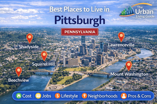
Join a local Pittsburgh guide for a comprehensive drive-and-walk tour through the most sought-after residential neighborhoods and hilltop enclaves across the city:
Key Residential Areas Across Pittsburgh in 2026
| Neighborhood Name | Location | Distance from Core (Downtown / Market Square) | Development Status | Transit Connectivity | Cost Level | Best Fit For |
|---|---|---|---|---|---|---|
| Shadyside | East End Corridor | Approximately 4 miles east | Historic Walkable Tree-Lined Urban | Exceptional (PRT East Busway, Fifth Ave) | High-to-Premium | Medical Fellows, Tech Professionals & Academics |
| Lawrenceville | Allegheny Riverfront Basin | Approximately 2.5 miles northeast | Adaptive Industrial Infill & Arts Corridor | High (PRT Bus Lines, Butler St, Penn Ave) | Mid-to-High Range | Young Professionals, Creatives & Robotics Engineers |
| Squirrel Hill | East End Parkside Ridge | Approximately 5 miles east | Established Multi-Family & Residential | High (PRT Route Networks, I-376, Forbes Ave) | Mid-to-High Range | Families, University Faculty & Long-Term Residents |
| Mount Washington | South Monongahela Bluff | Approximately 1.5 miles south | Historic Scenic Hilltop Overlook | Exceptional (Duquesne/Monongahela Inclines, PRT Red Line T) | Mid-Range | Downtown Commuters, View Enthusiasts & Buyers |
| Bloomfield | East Central Valley Basin | Approximately 3 miles east | Historic Working-Class Rowhouse Infill | High (PRT Bus Network, Liberty Ave, Penn Ave) | Accessible / Mid-Range | First-Time Homebuyers, Hospital Workers & Renters |
In-Depth Profiles of Top Pittsburgh Communities
Shadyside — Victorian Mansions, Boutique Shopping Strips & Academic Proximity
Positioned along the prestigious East End corridor between Fifth Avenue and the Martin Luther King Jr. East Busway, Shadyside is widely recognized as one of Pittsburgh’s most walkable, affluent, and architecturally cohesive residential neighborhoods. The community operates under City of Pittsburgh municipal services and is supported by the Shadyside Action Coalition. Shadyside is defined by mature hardwood canopies, historic brownstones, and three distinct walkable commercial retail corridors along Walnut Street, Ellsworth Avenue, and South Highland Avenue.
The neighborhood provides an upscale residential environment within a 5-minute commute of both Oakland universities and the Bakery Square tech center, making it the top choice for physicians, software engineers, and university faculty.
- Housing: Architectural inventory features grand Victorian mansions on Millionaire’s Row, restored 1920s brick rowhomes, classic brownstones, and modern luxury apartment mid-rises. Single-family home purchases typically range from $480,000 to $1,850,000+, while 1-to-2-bedroom rental apartments average $1,650 to $2,950 per month.
- Safety & Crime Rate: Patrolled by the Pittsburgh Police Zone 4 Precinct. Shadyside consistently records below-average violent and property crime rates compared to citywide benchmarks, supported by high pedestrian activity and active residential block watch networks.
- School District & Education Quality: Governed by Pittsburgh Public Schools (PPS), containing neighborhood options like Pittsburgh Liberty K-5 (acclaimed Spanish immersion magnet), while being minutes from elite independent preparatory schools including The Ellis School, Winchester Thurston School, and higher education at Carnegie Mellon University (CMU).
- Walkability & Daily Conveniences: Outstanding pedestrian walkability (Walk Score of 92-96/100). Residents comfortably walk to national retail flagships (Apple, lululemon, Sephora), indie bookstores, artisan bakeries, and grocers including Whole Foods Market on Centre Avenue, Trader Joe’s on Penn, and Giant Eagle Market District.
- Parks & Green Spaces / Pet-Friendliness: Direct walking access to the historic 456-acre Mellon Park (featuring walled formal perennial gardens, tennis centers, and the Pittsburgh Center for Arts & Media) and nearby Highland Park. Exceptionally dog-friendly with shaded sidewalk corridors.
- Parking & Traffic Congestion: Street parking is managed through the city residential permit parking system; private driveways add substantial value on older brick streets. Surface traffic slows along Fifth Avenue and Penn Avenue during morning commute hours.
- Noise Levels & Vibe: Refined, cultured, and social, characterized by sidewalk dining conversations, joggers under leafy canopies, and quiet residential side streets.
- Medical Facilities & Hospitals: Direct medical infrastructure anchored within the district by UPMC Shadyside Hospital on Centre Avenue and the Hillman Cancer Center.
- Transit Connectivity: Unmatched public transit access via the PRT Martin Luther King Jr. East Busway (Negley and Shadyside Stations), providing a direct 8-minute dedicated bus-rapid-transit ride into Downtown Pittsburgh, with road links to Fifth Avenue and I-376.
- Affordability: High-tier urban price structure for Allegheny County; elevated real estate acquisition costs are balanced by premier medical access, walkability, and strong property appreciation.
- Who It’s Best For: Medical fellows and physicians at UPMC, CMU and Pitt professors, tech professionals at Google and Duolingo, and buyers seeking classic architectural pedigree.
- Drawbacks: Higher purchase prices per square foot, competitive on-street parking near Walnut Street on weekends, and older home radiator heating overhead.
Lawrenceville — Industrial Riverfront Heritage, Robotics Hub & Hip Dining Strip
Stretching along the southern banks of the Allegheny River northeast of the Strip District, Lawrenceville (divided into Lower, Central, and Upper Lawrenceville) is internationally celebrated as a premier model of urban revitalization. Historically an industrial iron and steel manufacturing basin, the neighborhood operates under City of Pittsburgh municipal administration and is championed by Lawrenceville Corporation. Centered along the bustling commercial spine of Butler Street and Penn Avenue, Lawrenceville combines preserved 19th-century worker rowhouses with cutting-edge robotics corporate campuses, craft breweries, art galleries, and acclaimed bistros.
The district serves as the primary home for “Robotics Row,” housing corporate engineering hubs for autonomous vehicle and robotics developers within walking distance of lively social venues.
- Housing: Real estate stock features restored 19th-century brick worker rowhomes, modern architectural infill townhouses with rooftop decks, and converted industrial warehouse lofts. Single-family rowhome purchase prices typically range from $290,000 to $680,000+, while modern apartment rentals average $1,550 to $2,650 per month.
- Safety & Crime Rate: Patrolled by the Pittsburgh Police Zone 2 Precinct. The central Butler Street commercial corridor maintains safe, active foot traffic day and night, though standard city awareness is advised regarding vehicle larcenies on peripheral residential streets.
- School District & Education Quality: Governed by PPS, containing neighborhood campuses such as Pittsburgh Arsenal K-8 and Pittsburgh Sunnyside K-8, alongside specialized public magnet schools.
- Walkability & Daily Conveniences: Outstanding pedestrian walkability (Walk Score of 88-92/100). Residents walk to over 50 local eateries, independent coffee roasters, vintage boutiques, music halls, and local specialty markets, with major grocery retail at Shop ‘n Save on 56th and nearby Strip District markets.
- Parks & Green Spaces / Pet-Friendliness: Municipal greenspaces include Arsenal Park (a historic 20-acre park featuring tennis courts and open sports fields), Leslie Park, Bernard Dog Run, and the 300-acre historic grounds of Allegheny Cemetery (a scenic arboretum parkland open for walking and cycling). Exceptionally pet-friendly.
- Parking & Traffic Congestion: On-street parking is competitive on narrow historic rowhouse streets; newer construction townhomes feature built-in rear garages. Traffic slows along Butler Street and 40th Street Bridge during peak evening dining and commute hours.
- Noise Levels & Vibe: High-energy, artistic, and innovative, filled with tech engineers, outdoor patio chatter, and active weekend gallery crawls.
- Medical Facilities & Hospitals: Direct emergency medical coverage provided within the district by the 10-acre campus of UPMC Children’s Hospital of Pittsburgh on Penn Avenue.
- Transit Connectivity: High-frequency transit provided by PRT Bus Routes (Routes 61, 64, 87, and 91), offering a 12-minute commute into Downtown Pittsburgh, with road access via Butler Street, Penn Avenue, and the 40th Street Bridge connecting to Route 28.
- Affordability: Mid-to-high urban price tier; delivers modern contemporary townhome living and robotics employer proximity at rates competitive with East End enclaves.
- Who It’s Best For: Robotics engineers, autonomous vehicle tech workers, young professionals, healthcare staff at Children’s Hospital, and culinary enthusiasts.
- Drawbacks: Narrow residential streets with limited guest parking, ongoing infill construction activity, and steep price appreciation on renovated properties.
Squirrel Hill — Multi-Generational Community, Forbes Avenue Retail & Expansive Parklands
Covering the rolling elevated ridge between Frick Park and Schenley Park in the East End, Squirrel Hill (divided into Squirrel Hill North and South) is one of Pittsburgh’s most historically established, family-centric, and culturally vibrant communities. Operating under City of Pittsburgh municipal governance and supported by the Squirrel Hill Urban Coalition, the district is centered around the bustling commercial intersection of Forbes Avenue and Murray Avenue.
Celebrated for its historic brick architecture, diverse international dining scene, mature tree canopies, and direct access to over 1,000 acres of protected city parkland, Squirrel Hill combines suburban-style residential stability with complete urban walkability.
- Housing: Real estate stock features grand stone and brick Tudor Revival estates in Squirrel Hill North, classic 1920s brick four-squares, Dutch Colonial single-family homes, and mid-rise apartment cooperatives. Single-family purchase prices typically range from $380,000 to $1,450,000+, while residential rentals and flats average $1,350 to $2,350 per month.
- Safety & Crime Rate: Patrolled by the Pittsburgh Police Zone 4 Precinct. Squirrel Hill consistently posts some of the lowest violent and property crime metrics in the city, supported by deep community engagement and active neighborhood patrols.
- School District & Education Quality: Governed by PPS, containing top-performing public institutions such as Pittsburgh Colfax K-8, Pittsburgh Allderdice High School (renowned for its pre-engineering and AP programs), alongside prestigious independent private and parochial institutions.
- Walkability & Daily Conveniences: Outstanding pedestrian walkability (Walk Score of 88-92/100 around the commercial core). Residents walk to indie movie theaters at The Manor Theatre, historic bakeries, international grocery markets, and supermarkets including Giant Eagle on Murray.
- Parks & Green Spaces / Pet-Friendliness: World-class parkland access: framed on the west by the 456-acre Schenley Park (featuring the Phipps Conservatory, Bob O’Connor Golf Course, and running trails) and on the east by the 644-acre Frick Park (featuring the Frick Environmental Center, clay tennis courts, and the famous Regent Square Dog Park). Exceptionally pet-friendly.
- Parking & Traffic Congestion: Plentiful private residential driveways, detached garages, and metered district parking. Commuter traffic builds along Forbes Avenue and Forward Avenue leading to the I-376 Squirrel Hill Tunnel during peak rush hours.
- Noise Levels & Vibe: Grounded, multi-generational, and academic, characterized by children riding bicycles, students reading in cafes, and peaceful residential evenings.
- Medical Facilities & Hospitals: Direct 6-to-8 minute drive to the Oakland healthcare hub (UPMC Presbyterian, UPMC Montefiore, and UPMC Magee-Womens Hospital).
- Transit Connectivity: High-frequency transit via PRT Bus Routes (Routes 61A, 61B, 61C, 61D) providing a direct 15-minute ride to Downtown Pittsburgh and 5 minutes to Oakland, with immediate vehicular access to Interstate 376 (Penn-Lincoln Parkway).
- Affordability: Mid-to-high price profile; higher home acquisition costs are balanced by exceptional public school feeder patterns, park access, and multi-generational equity stability.
- Who It’s Best For: Families prioritizing public high school education (Allderdice), university faculty at Pitt and CMU, medical professionals, and nature lovers seeking massive urban park systems.
- Drawbacks: Substantial traffic congestion at the I-376 Squirrel Hill Tunnel during morning and evening rush hours, older home plumbing and radiator systems requiring updates, and higher price points in Squirrel Hill North.
Mount Washington — Iconic Skyline Views, Historic Funiculars & Overlook Dining
Perched atop the sheer 400-foot southern rock bluffs of the Monongahela River directly opposite Downtown Pittsburgh, Mount Washington (originally known as Coal Hill) is world-famous for its sweeping panoramic views of the Golden Triangle skyline and the Three Rivers confluence. Operating under City of Pittsburgh municipal oversight and guided by the Mount Washington Community Development Corporation, the neighborhood centers along the scenic promenade of Grandview Avenue.
The community combines iconic scenic tourism, fine dining atop the bluffs, historic 19th-century wooden incline funiculars, and quiet residential neighborhood streets.
- Housing: Real estate spans historic brick rowhomes, single-family wood-frame cottages, modern luxury cliff-side condominiums with floor-to-ceiling glass, and contemporary townhomes. Single-family and townhome purchase prices typically range from $210,000 to $750,000+ (with luxury cliff-front properties exceeding $1.5M), while rental apartments average $1,150 to $1,950 per month.
- Safety & Crime Rate: Patrolled by the Pittsburgh Police Zone 3 Precinct. Grandview Avenue and the primary residential tracts maintain safe, well-patrolled environments, though standard urban vigilance is advised on peripheral side streets.
- School District & Education Quality: Governed by PPS, containing public options such as Pittsburgh Whittier K-5 and Pittsburgh South Hills 6-8, alongside proximity to specialized magnet schools.
- Walkability & Daily Conveniences: The historic hilltop village along Shiloh Street and Virginia Avenue is pedestrian-friendly, featuring local bakeries, craft coffee houses, family taverns, and local markets, while cliffside Grandview Avenue hosts landmark fine dining establishments like the Monterey Bay Fish Grotto and The LeMont.
- Parks & Green Spaces / Pet-Friendliness: Direct access to the scenic 250-acre Emerald View Park (a continuous greenbelt winding around the hilltop featuring hiking trails, woodland overlooks, and historic picnic spots), Olympia Park, and Chatham Village Green. Highly pet-friendly with scenic walking paths.
- Parking & Traffic Congestion: Private driveways and street parking are common in residential sections; tourist parking is concentrated along Grandview Avenue. Commuter traffic slows near the Liberty Tunnel and McArdle Roadway access ramps during peak drive times.
- Noise Levels & Vibe: Scenic, proud, and active along the overlooks, transitioning to peaceful, tight-knit residential living on the interior streets.
- Medical Facilities & Hospitals: Direct 6-to-8 minute transit or vehicular access to UPMC Mercy Hospital on Boulevard of the Allies and AHN Jefferson Hospital facilities.
- Transit Connectivity: Unmatched historic and modern transit: served by two operating 19th-century funiculars—the Duquesne Incline and Monongahela Incline—providing a 3-minute ride down to Station Square, supplemented by the PRT Red Line Light Rail (T) and PRT Bus Routes (Route 40) into Downtown Pittsburgh.
- Affordability: Balanced mid-range price tier; delivers skyline views and rapid downtown transit access at price points significantly lower than East End enclaves.
- Who It’s Best For: Downtown corporate workers, young professionals, view enthusiasts, first-time homebuyers, and buyers seeking unique funicular transit.
- Drawbacks: Heavy weekend tourist foot and vehicle traffic along Grandview Avenue, steep hillside topography challenging during icy winter conditions, and older housing stock requiring cosmetic renovation.
Bloomfield — “Pittsburgh’s Little Italy,” Healthcare Corridors & Historic Rowhouse Value
Covering the established valley basin between Shadyside and Lawrenceville in the East End, Bloomfield is affectionately celebrated as “Pittsburgh’s Little Italy.” Settled in the late 19th and early 20th centuries by Italian immigrants, the community operates under City of Pittsburgh municipal administration and is supported by Bloomfield Development Corporation. Centered along the commercial corridor of Liberty Avenue, Bloomfield maintains an authentic working-class heritage, family-owned Italian markets, traditional bakeries, and direct proximity to major healthcare complexes.
The neighborhood provides an accessible, walkable entry point for first-time homebuyers, medical residents, and renters seeking central convenience.
- Housing: Real estate consists of historic two-to-three-story brick and vinyl-sided rowhouses, traditional two-family flats, and modern infill apartment communities along Liberty Avenue. Single-family rowhome purchase prices typically range from $220,000 to $420,000, while rental apartments and flats average $1,100 to $1,750 per month.
- Safety & Crime Rate: Patrolled by the Pittsburgh Police Zone 5 Precinct. Bloomfield maintains a safe, tight-knit residential core with high multi-generational family presence and active community vigilance, resulting in below-average violent crime rates.
- School District & Education Quality: Governed by PPS, containing neighborhood institutions such as Pittsburgh Woolslair PreK-5 (featuring STEAM magnet programs) and Pittsburgh Milliones 6-12, alongside nearby private and parochial schools.
- Walkability & Daily Conveniences: Outstanding pedestrian walkability (Walk Score of 90-94/100). Residents walk to traditional Italian grocers (Groceria Italiana), sausage markets, bakeries, indie coffee shops, pharmacies, and major supermarkets including West Penn Hospital Market and Giant Eagle on Shakespeare nearby.
- Parks & Green Spaces / Pet-Friendliness: Municipal recreation is anchored by Bloomfield Park (featuring public swimming pools, lighted dek hockey rinks, and skate parks) and walking access to the green meadows of Friendship Park. Dog-friendly with walkable sidewalk grids.
- Parking & Traffic Congestion: On-street parking is regulated by residential parking permits; streets are narrow, making dedicated rear parking pads valuable. Commuter traffic on Liberty Avenue and Main Street moves steadily.
- Noise Levels & Vibe: Community-centered, authentic, and bustling, characterized by neighbors chatting on front porches, outdoor bocce games, and lively crowds during the annual Little Italy Days festival.
- Medical Facilities & Hospitals: Direct medical anchor situated within the center of the neighborhood at AHN West Penn Hospital on Millvale Avenue.
- Transit Connectivity: High-frequency public transit provided by PRT Bus Routes (Routes 54, 64, 71A, 71C, 77, and 86) connecting directly to Downtown, Oakland, and the East End, with road links via Liberty Avenue and Penn Avenue.
- Affordability: Pittsburgh’s most accessible entry-level homeownership and rental price tier in the East End, offering lower mortgage entry requirements and strong long-term rental demand from hospital staff.
- Who It’s Best For: Healthcare professionals and nurses at West Penn or Children’s Hospital, first-time homebuyers, medical residents, and buyers seeking an authentic, walkable neighborhood community.
- Drawbacks: Dense, narrow residential streets with tight on-street parking, older housing infrastructure requiring plumbing and electrical updates, and crowded festival weekends.
Living Trade-offs Across Pittsburgh Communities
| Neighborhood | Core Advantages (Pros) | Core Limitations (Cons) |
|---|---|---|
| Shadyside | Walkable boutique dining on Walnut St; PRT East Busway 8-minute ride to Downtown; Mellon Park; UPMC Shadyside healthcare. | Higher purchase entry barrier; older home radiator heating overhead; competitive weekend retail street parking. |
| Lawrenceville | Vibrant arts and dining along Butler St; “Robotics Row” tech campuses; UPMC Children’s Hospital; modern townhomes with roof decks. | Narrow rowhouse streets with tight parking; ongoing construction noise; higher price appreciation on renovated homes. |
| Squirrel Hill | Framed by Frick Park and Schenley Park; top-performing Allderdice High school; diverse international dining on Forbes Ave. | Heavy rush-hour traffic bottlenecks at the I-376 Squirrel Hill Tunnel; older housing systems; high purchase prices in North sector. |
| Mount Washington | Panoramic Three Rivers and skyline views along Grandview Ave; historic Duquesne & Monongahela Inclines; PRT Light Rail T access. | Heavy weekend tourist foot traffic; steep hill roads challenging in winter ice; older housing stock requiring cosmetic updates. |
| Bloomfield | East End’s most accessible home and rental prices; authentic Italian delis and cafes on Liberty Ave; direct access to AHN West Penn Hospital. | Narrow residential streets with competitive parking; older home electrical systems; crowded street festival weekends. |
How to Navigate Your Pittsburgh Neighborhood Selection
Selecting your ideal neighborhood in Pittsburgh requires balancing your household budget with daily commute routes, hill topography, and bridge crossings. Because Pittsburgh is geographically shaped by three major rivers and steep ridgelines, your chosen location dictates whether your daily commute relies on dedicated transit like the PRT East Busway (Shadyside, East Liberty), light rail lines via the PRT T Subway (Mount Washington, South Hills), or navigating peak-hour traffic bottlenecks through the Fort Pitt, Liberty, or Squirrel Hill Tunnels.
Tech workers along Robotics Row, healthcare professionals at UPMC or AHN, and researchers at Carnegie Mellon or Pitt should prioritize living on the appropriate side of the river to eliminate bridge traffic delays.
Beyond transportation corridors, evaluate essential municipal utility and building infrastructure realities. Western Pennsylvania experiences sub-freezing winter temperatures with snowfall alongside humid summer conditions, making home heating efficiency and utility reliability through Duquesne Light Company (DLC) and Peoples Natural Gas an important factor.
In addition, prospective homebuyers evaluating historic brick rowhouses in Lawrenceville or Victorian homes in Shadyside should inspect century-old masonry, clay sewer lines, and cast-iron radiator boilers. Before executing a residential lease or property purchase agreement, verify high-speed fiber broadband availability (such as Verizon Fios or Xfinity Gigabit) and confirm Pittsburgh Public Schools feeder boundaries.
Essential Local Insights & FAQs for Pittsburgh
Which neighborhood in Pittsburgh is considered best for families with children?
Squirrel Hill and Shadyside are widely regarded as premier family communities in Pittsburgh. Squirrel Hill provides access to top-performing public schools like Pittsburgh Colfax K-8 and Allderdice High School, flanked by over 1,000 acres of parkland at Frick and Schenley Parks. Shadyside offers historic tree-lined streets, access to Pittsburgh Liberty’s language immersion magnet program, and proximity to elite private preparatory academies.
What is the most walkable neighborhood in Pittsburgh where you can live without a car?
Shadyside, Lawrenceville, and Bloomfield offer the highest walkability in Pittsburgh, each scoring above 90 on Walk Score. Shadyside allows residents to complete daily errands on foot, walk to multiple grocery stores like Whole Foods and Trader Joe’s, and access the PRT East Busway for an 8-minute dedicated bus-rapid-transit ride into Downtown. Lawrenceville and Bloomfield provide dense pedestrian access to shopping, dining, and healthcare centers along Butler Street and Liberty Avenue.
What are the safest residential neighborhoods to live in within Pittsburgh?
Squirrel Hill, Shadyside, and Mount Washington consistently report below-average violent and property crime rates in Allegheny County. Squirrel Hill and Shadyside benefit from established multi-generational owner-occupancy and active community block watch networks, while Mount Washington maintains dedicated police patrols and high pedestrian visibility along its overlook promenades.
What are the most affordable neighborhoods for homebuyers and renters in Pittsburgh?
Bloomfield, Greenfield, and Mount Washington provide the most budget-friendly housing opportunities near central employment hubs. In Bloomfield, buyers and renters can secure historic brick rowhouses and apartments at price points significantly lower than neighboring Shadyside or Lawrenceville, while retaining direct access to healthcare employers and public transit.
How bad is traffic congestion when commuting across Pittsburgh bridges and tunnels?
Traffic congestion on Pittsburgh bridges and tunnel corridors—particularly the Squirrel Hill Tunnel on I-376, the Fort Pitt Tunnel on I-279, and the Liberty Tunnels—is significant during morning and evening rush hours. Utilizing the PRT East Busway or the PRT Light Rail T system provides a dependable alternative to bypass highway gridlock.
Which Pittsburgh neighborhood is best for healthcare professionals working at UPMC or AHN?
Shadyside, Bloomfield, and Lawrenceville provide the fastest commutes to major medical campuses. Shadyside hosts UPMC Shadyside Hospital and Hillman Cancer Center, Bloomfield is centered directly around AHN West Penn Hospital, and Lawrenceville is home to UPMC Children’s Hospital of Pittsburgh, allowing medical staff to walk or take a 3-minute transit ride to work.
Is Pittsburgh an affordable place to live compared to East Coast metropolitan areas?
Yes, Pittsburgh’s overall cost of living and housing prices are significantly lower than Philadelphia, New York City, and Washington, D.C., offering historic single-family homes, lower rental rates, and spacious urban living at a fraction of regional East Coast real estate costs.
Relocation Resources & Living Guides
The Urban Living Guide creates deeply researched, practical, and informative city relocation resources designed to help individuals, working professionals, and families navigate complex urban landscapes. By analyzing municipal infrastructure, hyper-local zoning patterns, commuter realities, and housing markets, our guides provide actionable insights so you can make confident, data-backed decisions when moving to major metropolitan areas.
Explore our regional guides across Pittsburgh and Western Pennsylvania:
- Living in Pittsburgh, Pennsylvania
- Cost of Living in Pittsburgh, Pennsylvania
- Pros and Cons of Living in Pittsburgh, Pennsylvania
Made your decision to move to the Steel City? Read our comprehensive relocation roadmap: Moving to Pittsburgh, Pennsylvania.
Follow The Urban Living Guide for ongoing regional insights, neighborhood developments, and expert local coverage across Greater Pittsburgh and the Commonwealth of Pennsylvania.