

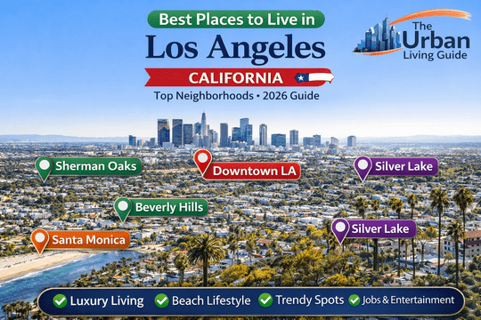
Best Neighborhoods in Los Angeles, California: Complete Relocation & Livability Guide in 2026
Spanning across 469 square miles of diverse Southern California basin and coastal terrain, the City of Los Angeles operates under the municipal jurisdiction of the City of Los Angeles and the broader governance of Los Angeles County. Housing an urban core population of approximately 3.82 million residents within city boundaries and exceeding 9.86 million people countywide, this sprawling metropolis encompasses over 100 distinct neighborhood councils, historic enclaves, and independent incorporated municipalities. Deciding where to establish residency requires analyzing localized infrastructure, complex zoning jurisdictions, microclimates ranging from marine layers to valley heat corridors, and regional commuter pathways controlled by the California Department of Transportation.
Residential distribution in greater Los Angeles reflects marked demographic and geographical divides, separating dense basin centers from quiet foothill communities and bustling beachside avenues. Inbound residents routinely balance proximity to major employment epicenters like Silicon Beach, Century City, Studio City, and the Downtown Financial District against variable housing densities and transit corridors. Selecting the appropriate residential pocket dictates daily exposure to municipal utility grids, regional air quality index patterns, local public safety dispatch divisions, and the daily reality of highway interchanges such as Interstate 405 (San Diego Freeway), Interstate 10 (Santa Monica Freeway), and US Route 101 (Ventura Freeway).
| Metric / Attribute | Municipal Data & Operational Statistics |
|---|---|
| Municipal Land Area | Approximately 469.0 square miles (Incorporated City) |
| Core City Population | Approximately 3,820,000 to 3,890,000 residents |
| County Population | Approximately 9,860,000 to 10,010,000 residents |
| Primary Public Transit Authority | Los Angeles County Metropolitan Transportation Authority (LACMTA / Metro) |
| Primary School District | Los Angeles Unified School District (LAUSD) |
| Median Home Price Benchmark | Typically ranges around $900,000 to $1,250,000 citywide |
| Average 1-Bedroom Rental Cost | Typically ranges around $2,200 to $3,100 per month depending on submarket |
Watch this video to explore different neighborhoods, streetscapes, and housing styles across Los Angeles:
Best Areas to Live in Los Angeles at a Glance in 2026
| Sr No | Neighborhood Name | Location | Distance from Core (DTLA) | Development Status | Transit Connectivity | Cost Level | Best Fit For |
|---|---|---|---|---|---|---|---|
| 1 | Sherman Oaks | San Fernando Valley | Approximately 15 miles northwest | Established Suburban | Moderate (Buses, US-101, I-405) | Mid-to-High Range | Families & Valley Professionals |
| 2 | Downtown Los Angeles (DTLA) | Central Los Angeles | 0 miles (Urban Core) | High-Density Urban Hub | Exceptional (Metro Rail Hub, Union Station) | Mid-to-High Range | Corporate & Creative Professionals |
| 3 | Beverly Hills | Westside (Independent City) | Approximately 10 miles west | Ultra-Luxury Residential | Moderate (Bus lines, upcoming D Line Subway) | Ultra-Premium | High-Net-Worth Executives & Families |
| 4 | Santa Monica | Westside Coastline | Approximately 15 miles west | Established Coastal-Urban | High (Metro E Line, Big Blue Bus) | High to Premium | Tech Workers & Beach Enthusiasts |
| 5 | Koreatown (K-Town) | Central Los Angeles | Approximately 3 miles west | High-Density Mixed-Use | High (Metro B Line, D Line, Rapid Buses) | Accessible to Mid-Range | Budget Renters, Students & Commuters |
Best Neighborhoods in Los Angeles Discussed in Detail
Sherman Oaks — Tree-Lined Suburban Sanctuary & Valley Commercial Hub
Positioned along the base of the Santa Monica Mountains in the southern San Fernando Valley, Sherman Oaks delivers a balanced suburban atmosphere framed by deep commercial nodes along Ventura Boulevard. Primarily developed with single-family mid-century residential tracts and garden-style apartment courts north of Magnolia Boulevard, the community attracts established households seeking generous square footage, private yards, and reduced street congestion compared to the basin. Civic services operate under municipal oversight from the Los Angeles City Planning Department, maintaining structured neighborhood preservation corridors.
- Housing: Architectural inventory ranges from 1950s ranch-style homes, contemporary modern farmhouse rebuilds, and gated multi-family complexes, to hilltop estates located south of Ventura Boulevard. Single-family purchase valuations typically range around $1,350,000 to $2,800,000, while modern apartment rentals average $2,300 to $3,450 per month.
- Safety & Crime Rate: Patrolled by the LAPD Van Nuys Community Police Station, property crimes remain lower than central basin neighborhoods, though vehicular break-ins occur along busy retail corridors on Sepulveda Boulevard.
- School District & Education Quality: Served by Los Angeles Unified School District (LAUSD) Board District 3, hosting top-performing public institutions such as Sherman Oaks Elementary Charter, Kester Avenue Elementary, and Dixie Canyon Community Charter, alongside private options including The Buckley School.
- Walkability & Daily Conveniences: The neighborhood features high pedestrian activity along the Ventura Boulevard commercial spine, anchored by organic grocers, independent cafes, and shopping venues like Sherman Oaks Galleria and Westfield Fashion Square, while residential interior streets remain quiet and car-dependent.
- Parks & Green Spaces / Pet-Friendliness: The Van Nuys Sherman Oaks Recreation Center on Huston Street provides multi-sport baseball diamonds, soccer fields, an outdoor swimming pool, tennis courts, and enclosed play structures. Dog owners frequently utilize nearby walking routes along Chandler Boulevard.
- Parking & Traffic Congestion: Street parking is manageable across residential zones, though major commuter bottlenecks emerge during peak hours at the intersection of Interstate 405 and US Route 101 (the Sepulveda Pass corridor).
- Noise Levels & Vibe: Relaxed, quiet residential pockets with minimal background ambient noise, shifting to steady commercial activity along primary east-west arterial boulevards.
- Medical Facilities & Hospitals: Immediate emergency and specialized medical care is anchored by Sherman Oaks Hospital on Van Nuys Boulevard and nearby Encino Hospital Medical Center.
- Transit Connectivity: Commuter access relies on Metro Bus Lines 150/240, the Metro G Line (Orange) dedicated busway to the north in Van Nuys, and rapid highway connections via US-101 and I-405.
- Affordability: Mid-to-high cost profile, offering substantially larger lot footprints and living square footage per dollar compared to Westside enclaves like Brentwood or Santa Monica.
- Who It’s Best For: Families prioritizing public charter school access, remote executives requiring home offices, and entertainment professionals working at studios in Burbank, Universal City, or Studio City.
- Drawbacks: Summer temperatures routinely register 10 to 15 degrees Fahrenheit warmer than coastal zones, and driving through the Sepulveda Pass during peak hours can add 45 to 60 minutes to Westside commutes.
Downtown Los Angeles (DTLA) — High-Density Urban Core & Historic Loft Center
Reinvented over the past two decades through adaptive reuse zoning, Downtown Los Angeles (DTLA) serves as the central governmental, legal, financial, and transit nexus of the region. Comprising micro-districts such as the South Park residential district, Historic Core, Arts District, Bunker Hill, and Financial District, DTLA offers genuine vertical urbanism. Direct governance falls under the City of Los Angeles, with transit routing anchored by regional terminals operated through LACMTA.
- Housing: Predominantly industrial converted warehouse lofts, mid-century high-rises, and newly constructed glass luxury residential towers like those lining Olympic Boulevard and Grand Avenue. Rental prices for standard studio and 1-bedroom apartments typically range around $2,100 to $3,600 per month, while loft condominiums range around $550,000 to $1,400,000.
- Safety & Crime Rate: Varies significantly block-by-block. Patrolled by the LAPD Central Community Police Station, South Park and Bunker Hill experience dedicated private security district patrols, while areas bordering Skid Row (east of Los Angeles Street) experience high rates of property and street-level crime.
- School District & Education Quality: Governed by LAUSD, including specialized institutions such as the Ramón C. Cortines School of Visual and Performing Arts and Downtown Magnets High School, though primary neighborhood-level elementary school options remain limited.
- Walkability & Daily Conveniences: Exceptionally walkable with a Walk Score frequently exceeding 90/100; residents easily access daily essentials at Whole Foods Market on 8th Street, Ralphs Fresh Place on 9th Street, and cultural destinations like The Broad, Walt Disney Concert Hall, and Crypto.com Arena.
- Parks & Green Spaces / Pet-Friendliness: Modest green footprint centered on Grand Park, Pershing Square (under continuous municipal revitalization), and the Arts District Dog Park. The area is highly pet-friendly within residential buildings, though outdoor green spaces are paved or manicured.
- Parking & Traffic Congestion: Assigned parking typically costs an additional $150 to $350 per month per vehicle in residential towers. Street parking is strictly metered, and highway access points to Interstate 110 (Harbor Freeway) and US-101 face heavy peak gridlock.
- Noise Levels & Vibe: Fast-paced, vibrant, and energetic, with constant background urban soundscapes including siren activity, construction, delivery logistics, and nightlife foot traffic.
- Medical Facilities & Hospitals: Served immediately by Dignity Health – California Hospital Medical Center on Grand Avenue and Good Samaritan Hospital on Wilshire Boulevard.
- Transit Connectivity: Unmatched connectivity. Serviced directly by 7th Street / Metro Center and Los Angeles Union Station, offering access to the Metro A, B, D, and E Lines, Metrolink regional commuter trains, and Amtrak Pacific Surfliner rail service.
- Affordability: Mid-range to premium cost structure; competitive price-per-square-foot on older converted lofts offset by high homeowner association (HOA) dues and vehicle storage charges.
- Who It’s Best For: Young professionals, corporate attorneys, financial analysts, architectural creatives, and urbanites seeking a car-free or transit-accessible lifestyle.
- Drawbacks: Visible homelessness challenges in specific micro-pockets, higher property crime rates, scarce public green space, and substantial ongoing construction disruptions.
Beverly Hills — Premier Luxury Enclave & Globally Renowned Residential District
Operating as an independent municipal corporation surrounded by the City of Los Angeles, Beverly Hills represents one of the most affluent and strictly regulated residential addresses in the United States. Spanning south from the foothills of the Santa Monica Mountains past Wilshire Boulevard, the city features immaculate street sweeping schedules, dedicated municipal services, and world-class retail along the Rodeo Drive Golden Triangle. Municipal records and local ordinances are administered independently through the City of Beverly Hills Municipal Portal.
- Housing: Real estate in the northern flatlands and hills consists of historic Spanish Colonial, French Normandy, and contemporary mega-mansions on expansive multi-acre lots. South of Wilshire Boulevard, the market includes boutique luxury condominiums and Spanish-style multi-family duplexes. Detached home prices typically range around $3,500,000 to $25,000,000+, while luxury condo rentals average $3,800 to $12,000 per month.
- Safety & Crime Rate: Monitored by the independent Beverly Hills Police Department (BHPD), which maintains emergency response times averaging under 3 minutes alongside extensive municipal CCTV camera coverage across every major intersection.
- School District & Education Quality: Operates its own elite public school system, the Beverly Hills Unified School District (BHUSD), featuring highly rated institutions such as Beverly Vista Middle School and Beverly Hills High School.
- Walkability & Daily Conveniences: The commercial flatlands south of Santa Monica Boulevard are exceptionally walkable, granting pedestrian access to luxury flagships, gourmet markets like Bristol Farms and Whole Foods, and world-class fine dining along Canon Drive. Foothill and hillside zones are exclusively car-dependent.
- Parks & Green Spaces / Pet-Friendliness: Features manicured municipal parks including the Beverly Gardens Park (spanning 22 blocks along Santa Monica Boulevard), Coldwater Canyon Park, and Roxbury Park, which features lawn bowling, tennis courts, and children’s recreation grounds.
- Parking & Traffic Congestion: Strict overnight street parking permits keep neighborhood streets clear. High daytime pass-through traffic backs up along Wilshire Boulevard, Olympic Boulevard, and Santa Monica Boulevard.
- Noise Levels & Vibe: Extremely quiet, private, and manicured in residential zones north of Santa Monica Boulevard, transitioning to energetic high-end commercial foot traffic within the business core.
- Medical Facilities & Hospitals: Direct access to the internationally ranked Cedars-Sinai Medical Center, located immediately on the city’s eastern border on Beverly Boulevard.
- Transit Connectivity: Road connectivity via Santa Monica Boulevard (Route 2), Wilshire Boulevard, and regional Metro rapid bus lines, with direct subway access expanding via the Metro D Line (Purple) Extension Project along Wilshire.
- Affordability: Ultra-premium pricing across real estate, property taxes, municipal fees, and local consumer services.
- Who It’s Best For: High-net-worth families, established entertainment executives, global investors, and medical professionals seeking exceptional municipal security and premier public schools.
- Drawbacks: Extreme entry-level housing costs, restrictive historic preservation and building permit processes, and heavy daytime tourist traffic near the commercial Golden Triangle.
Santa Monica — Coastal Tech Hub & Active Oceanfront Community
Positioned along the Pacific coastline of West Los Angeles, the incorporated city of Santa Monica blends beachfront living with a dense commercial economy driven by the Silicon Beach technology sector. Encompassing distinct micro-neighborhoods such as the quiet tree-lined streets of North of Montana, the mid-city medical corridor along Wilshire Boulevard, and the bustling urban core around Downtown Santa Monica and Ocean Park, this coastal community operates under its own municipal administration via the City of Santa Monica Official Portal.
- Housing: Real estate ranges from multi-million dollar architectural estates in North of Montana, craftsman bungalows in Ocean Park, to contemporary mid-rise apartment flats and condominiums near Lincoln Boulevard. Single-family purchase prices typically range around $1,850,000 to $6,500,000+, while apartment rentals average $2,800 to $4,600 per month.
- Safety & Crime Rate: Patrolled by the independent Santa Monica Police Department (SMPD). Residential areas north of Wilshire maintain low violent crime rates, though bike theft and property crimes are prevalent near Santa Monica Pier and Downtown Santa Monica transit stops.
- School District & Education Quality: Governed by the highly regarded Santa Monica-Malibu Unified School District (SMMUSD), featuring institutions such as Franklin Elementary, Roosevelt Elementary, and Santa Monica High School (Samohi).
- Walkability & Daily Conveniences: Outstanding walkability and micro-mobility infrastructure. Residents easily complete errands on foot along Montana Avenue, Main Street, and Third Street Promenade, utilizing dedicated protected bike lanes across Broadway and Ocean Avenue.
- Parks & Green Spaces / Pet-Friendliness: Outstanding coastal recreation options anchored by Palisades Park perched over coastal bluffs, the Marvin Braude Bike Trail (The Strand) stretching 22 miles along the sand, and Clover Park featuring sports fields and dog recreation lawns.
- Parking & Traffic Congestion: Strictly enforced residential permit parking districts. Vehicular movement along the Pacific Coast Highway (PCH) and the western terminus of Interstate 10 slows significantly during weekends and evening commutes.
- Noise Levels & Vibe: Oceanfront breeze and coastal calm characterize early mornings, shifting to lively tourist and shopping activity during afternoons and warm summer weekends.
- Medical Facilities & Hospitals: Outstanding medical infrastructure anchored within city borders by UCLA Santa Monica Medical Center and Providence Saint John’s Health Center.
- Transit Connectivity: Exceptional transit integration highlighted by the Metro E Line light rail connecting Downtown Santa Monica directly to DTLA, supported by the extensive Big Blue Bus municipal transit fleet.
- Affordability: High-tier living costs, with substantial municipal sales taxes, premium property assessments, and elevated local rental rates.
- Who It’s Best For: Technology professionals working in Silicon Beach, fitness-minded outdoor enthusiasts, healthcare specialists, and families seeking high-performing public schools in a coastal microclimate.
- Drawbacks: Heavy coastal tourist congestion during peak seasons, dense marine layer fog (May Gray / June Gloom), and high local rental and parking costs.
Koreatown (K-Town) — High-Energy Urban Enclave & Central Transit Hub
Encompassing approximately 2.7 square miles west of Downtown and east of Mid-Wilshire, Koreatown is one of the densest and most culturally dynamic neighborhoods in the United States. Characterized by 24-hour dining establishments, historic Art Deco apartment towers, and sleek modern infill podium developments along Wilshire Boulevard and Olympic Boulevard, K-Town provides a central, highly accessible urban home base. The district is governed under the jurisdiction of the City of Los Angeles Neighborhood Councils.
- Housing: Dominated by multi-family rental buildings, including 1920s brick apartment buildings, mid-century dingbat complexes, and newly developed glass-and-steel mixed-use residential complexes. Monthly rental rates typically range around $1,650 to $2,500 for studio/1-bedroom units, while condominium sales range around $450,000 to $850,000.
- Safety & Crime Rate: Patrolled by the LAPD Olympic Community Police Station on Vermont Avenue. Property crimes, including automotive break-ins and bicycle theft, occur at moderate-to-high frequencies, while residential side streets remain active throughout the night.
- School District & Education Quality: Governed by LAUSD Board District 2, hosting local facilities such as Charles H. Kim Elementary and Robert F. Kennedy Community Schools complex on the historic Ambassador Hotel site.
- Walkability & Daily Conveniences: Exceptional walkability with major 24/7 retail centers, international supermarkets like H Mart on Madang Plaza and Galleria Market, alongside an internationally acclaimed culinary scene spanning 8th Street and 6th Street.
- Parks & Green Spaces / Pet-Friendliness: Public park green space is limited within core neighborhood boundaries. Residents rely on Seoul International Park on San Marino Street and pocket plazas, while dog owners frequently use private apartment dog runs.
- Parking & Traffic Congestion: Street parking is notoriously scarce, ranking among the most difficult parking environments in Los Angeles. Securing an apartment lease with an assigned, deeded garage parking space is essential. Arterials such as Vermont Avenue and Western Avenue experience heavy daily gridlock.
- Noise Levels & Vibe: Vibrant, high-energy 24-hour lifestyle with consistent street traffic, sirens, late-night dining patrons, and active commercial storefronts.
- Medical Facilities & Hospitals: Proximate to Southern California Hospital at Hollywood and St. Vincent Medical Center facilities, with major clinics lining Wilshire Boulevard.
- Transit Connectivity: Excellent subterranean rail connectivity via the Metro B Line (Red) and Metro D Line (Purple) subway stations along Wilshire Boulevard at Vermont, Normandie, and Western, enabling 10-minute transit commutes into Downtown LA.
- Affordability: Highly accessible relative to neighboring Westside districts, offering some of the most competitive central basin rental rates per square foot in Los Angeles.
- Who It’s Best For: Young professionals, remote workers, students at nearby USC or Southwestern Law School, food enthusiasts, and non-car owners seeking convenient transit rail access.
- Drawbacks: Extreme street parking deficits for guests and multi-vehicle households, limited public green parks, and high ambient nighttime noise levels.
Comprehensive Neighborhood Pros and Cons Comparison
| Neighborhood | Core Advantages (Pros) | Core Limitations (Cons) |
|---|---|---|
| Sherman Oaks | Spacious single-family residential layouts; exceptional charter school zoning; lower density; strong dining along Ventura Boulevard. | Severe Sepulveda Pass commute delays into West LA; elevated summer heat corridors; high dependence on personal vehicles. |
| Downtown LA (DTLA) | Central regional rail connectivity via 7th St / Metro Center; authentic industrial lofts; walkable access to corporate financial hubs and sports arenas. | Noticeable socioeconomic divides and visible homelessness; steep monthly parking fees; high street noise; sparse green parkland. |
| Beverly Hills | Dedicated BHPD municipal police protection; top-tier BHUSD schools; pristine civic landscaping and world-class retail luxury. | High cost of entry; restrictive municipal zoning and renovation permits; significant pass-through commuter traffic on main boulevards. |
| Santa Monica | Immediate beachfront access; refreshing marine climate; high bicycle and walking infrastructure; independent SMMUSD school district. | High coastal property and rental valuations; heavy weekend tourist congestion; dense marine layer during early summer months. |
| Koreatown | Competitive urban rental pricing; central positioning between Downtown and the Westside; 24-hour commercial vibrancy; direct subway access. | Acute shortage of residential and guest street parking; minimal public open park spaces; elevated ambient street noise. |
How You Decide Which Neighborhood Is Best For You
Evaluating where to live in Los Angeles requires aligning your gross household budget with day-to-day lifestyle parameters, regional commuting thresholds, and utility infrastructure reliability. Because Los Angeles County spans distinct topographical zones divided by the Santa Monica Mountain Range, your choice of neighborhood dictates whether your daily commute relies on heavily congested highway corridors like I-405 and I-10 or on direct light rail connections via the Metro E Line or B/D Line Subways. Prospective residents commuting to physical corporate offices in Century City, Silicon Beach, or Burbank should prioritize minimizing physical travel across mountain passes and freeway interchanges over maximizing interior residential square footage.
Beyond traffic logistics, evaluate regional infrastructure realities such as utility stability, air quality variance, and digital connectivity. Neighborhoods in the San Fernando Valley experience higher summer cooling electricity demands on the Los Angeles Department of Water and Power (LADWP) grid, while coastal communities like Santa Monica enjoy temperate marine conditions year-round. Ensure that multi-family apartment complexes or single-family properties offer verified high-speed fiber internet infrastructure (such as AT&T Fiber or Spectrum Gigabit), verify designated off-street deeded parking allocations, and review local municipal water service quality before executing long-term lease or purchase contracts.
Frequently Asked Questions About Los Angeles Neighborhoods
Which neighborhood in Los Angeles is considered the best overall for raising a family?
Sherman Oaks is widely regarded as an exceptional option for families due to its larger residential lot dimensions, quiet tree-lined suburban side streets, and concentration of high-performing public charter institutions like Sherman Oaks Elementary Charter. For families prioritizing an independent municipal school system and dedicated local emergency services, Beverly Hills provides top-tier educational infrastructure through the Beverly Hills Unified School District alongside dedicated community recreation facilities.
What is the most walkable neighborhood in Los Angeles where you can live without a car?
Downtown Los Angeles (DTLA) and Santa Monica offer the highest walkability ratings in the region. DTLA allows residents to complete all daily errands on foot and access regional rail lines via the 7th Street / Metro Center transit hub. Santa Monica combines high neighborhood walkability along Montana Avenue and Main Street with extensive bicycle networks and direct light rail connectivity via the Metro E Line.
What are the safest residential neighborhoods to live in within Los Angeles County?
Independent incorporated cities like Beverly Hills rank among the safest areas due to dedicated municipal police departments, low emergency response times, and extensive citywide surveillance systems. Within the incorporated City of Los Angeles limits, suburban San Fernando Valley enclaves such as Sherman Oaks and hillside communities south of Ventura Boulevard report lower violent crime statistics compared to dense central basin districts.
What are the most affordable neighborhoods in central Los Angeles for renters?
Koreatown offers some of the most competitive rental price points in the central basin, with standard studio and one-bedroom apartments renting for hundreds of dollars less per month than comparable units in Downtown LA or the Westside. Its central positioning and direct subway connectivity via the Metro B and D Lines make it a practical hub for value-conscious residents.
How significantly does living near the coast impact summer temperatures compared to the Valley?
Living in coastal neighborhoods like Santa Monica provides natural ocean breezes and marine layers, keeping average summer high temperatures around 72 to 78 degrees Fahrenheit. In contrast, inland valley neighborhoods like Sherman Oaks frequently experience summer heat waves exceeding 90 to 100 degrees Fahrenheit, resulting in substantially higher air conditioning utility costs through the Los Angeles Department of Water and Power.
Is street parking included with residential leases in dense Los Angeles neighborhoods?
Street parking is rarely guaranteed and is heavily restricted across dense neighborhoods such as Koreatown and Downtown Los Angeles. In these areas, street parking spaces are competitive and subject to weekly street sweeping restrictions and permit regulations. Securing a lease that includes dedicated, off-street assigned garage parking is highly recommended for car owners.
Which neighborhood offers the best access for working in the Silicon Beach tech sector?
Santa Monica is the premier residential base for professionals employed in Silicon Beach, offering direct proximity to tech headquarters, co-working facilities, and venture capital offices scattered throughout Santa Monica, Venice, and Playa Vista without requiring lengthy freeway travel.
Know More About the City
The Urban Living Guide creates deeply researched, practical, and informative city relocation resources designed to help individuals, working professionals, and families navigate complex urban landscapes. By analyzing municipal infrastructure, hyper-local zoning patterns, commuter realities, and housing markets, our guides provide actionable insights so you can make confident, data-backed decisions when moving to major metropolitan areas.
Explore our comprehensive guides to the Los Angeles metropolitan region:
- Living in Los Angeles, California
- Cost of Living in Los Angeles, California
- Pros and Cons of Living in Los Angeles, California
- Moving to Los Angeles, California
Follow The Urban Living Guide for ongoing regional insights, neighborhood developments, and expert local coverage across Southern California.