

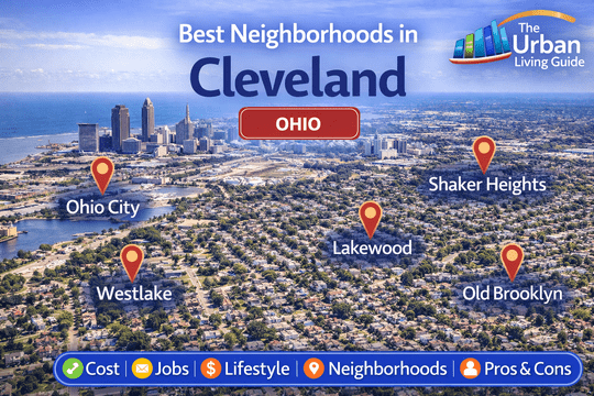
Best Neighborhoods in Cleveland: Lake Erie Shorelines, Historic Market Districts & Urban Enclaves in 2026
Covering approximately 77.7 square miles of land area along the southern freshwater coast of Lake Erie where the Cuyahoga River enters the basin in Cuyahoga County, the City of Cleveland operates under the mayor-council municipal administration of the City of Cleveland. Housing an incorporated municipal core population exceeding 367,000 residents and anchoring a broader Greater Cleveland metropolitan region of over 2.15 million people, the “Forest City” stands as an essential national center for world-class biomedical research, advanced manufacturing, legal commerce, and cultural arts.
Relocating across Northeast Ohio requires evaluating distinct east-west geographic splits, lake-effect winter climate patterns, and regional commuter transit networks operated by the Greater Cleveland Regional Transit Authority (GCRTA). Inbound movers consistently balance direct access to primary regional employers—including the world-renowned medical headquarters of the Cleveland Clinic Main Campus, University Hospitals Cleveland Medical Center, MetroHealth System, Fortune 500 corporate anchors like Sherwin-Williams (Global HQ Downtown) and KeyCorp, and higher-education research at Case Western Reserve University (CWRU)—against daily highway travel across Interstate 90, Interstate 71, Interstate 77, State Route 2 (Memorial Shoreway), and Opportunity Corridor Boulevard, with regional air links via Cleveland Hopkins International Airport (CLE).
Take a guided local tour through the market avenues, waterfront parks, and distinctive residential neighborhoods across Cleveland, Ohio:
Key Residential Areas in Cleveland at a Glance in 2026
| Neighborhood | Location | Distance to Public Square | Development Status | Transit Connectivity | Cost Level | Best Fit For |
|---|---|---|---|---|---|---|
| Ohio City | Near West Side | ~1.5 mi west | Historic Market & Modern Infill | Exceptional (GCRTA Red Line, W 25th St) | Mid-to-High | Young Professionals, Foodies & Creatives |
| Tremont | Southwest Valley Bluff | ~2 mi south | Historic Victorian Arts District | High (I-90, I-490, Professor Ave) | Mid-to-High | Culinary Staff, Artists & Downtown Commuters |
| University Circle | East Side Arts Corridor | ~4.5 mi east | High-Density Medical & Academic | Exceptional (GCRTA HealthLine BRT, Red Line) | High-to-Premium | Physicians, Researchers & CWRU Faculty |
| Edgewater (Detroit-Shoreway) | Northwest Lakefront | ~3 mi west | Lakefront Coastal & Historic Infill | High (Route 2 / Shoreway, Detroit Ave) | Mid-to-High | Beach Lovers, Commuters & Dog Owners |
| Kamm’s Corners (West Park) | Far West Basin | ~8 mi southwest | Established Mid-Century Suburban | High (GCRTA Red Line – Puritas, I-71, I-90) | Accessible / Mid-Range | Families, First-Time Buyers & Airport Personnel |
Comprehensive Breakdown of Living Options Across Cleveland
Ohio City — Historic West Side Market, Craft Brewing Corridor & Rapid Rail Transit
Situated immediately across the Cuyahoga River from Downtown Cleveland, Ohio City is widely celebrated as one of the Midwest’s most culturally vibrant, culinarily celebrated, and historic urban neighborhoods. Operating under City of Cleveland municipal planning and championed by Ohio City Incorporated, the community centers along the bustling commercial spine of West 25th Street and Lorain Avenue.
The neighborhood is defined by preserved 19th-century Victorian brick townhomes, independent craft breweries (anchored by Great Lakes Brewing Company), artisan coffee roasters, and direct heavy-rail subway transit into downtown and the airport.
- Housing: Real estate inventory spans restored 19th-century Victorian Italianate brick homes, modern architectural infill townhouses with private rooftop terraces, converted industrial lofts, and contemporary multi-family mid-rises. Single-family purchase prices typically range from $280,000 to $680,000+, while modern rental apartments average $1,350 to $2,450 per month.
- Safety & Crime Rate: Patrolled by the Cleveland Division of Police (CDP) 2nd District and supported by dedicated neighborhood safety patrols. Commercial corridors along West 25th Street maintain steady foot traffic and high safety, though standard city awareness is advised regarding vehicle larcenies on outer residential streets.
- School District & Education Quality: Governed by the Cleveland Metropolitan School District (CMSD), containing neighborhood institutions such as Paul L. Dunbar School and Near West Intergenerational School, alongside prestigious private institutions like Saint Ignatius High School (renowned Jesuit college preparatory academy founded in 1886).
- Walkability & Daily Conveniences: Outstanding pedestrian walkability (Walk Score of 90-94/100). Residents walk to over 40 local restaurants, craft tasting rooms, bakeries, indie shops, and fresh produce stalls at the historic 1912 West Side Market (featuring over 80 independent food purveyors).
- Parks & Green Spaces / Pet-Friendliness: Municipal recreation is anchored by Fairview Park (featuring splash pads, community gardens, and lighted diamonds), Greenwood Park, and the 20-acre Irishtown Bend Park riverfront park system currently transforming the Cuyahoga River hillside. Exceptionally pet-friendly.
- Parking & Traffic Congestion: Plentiful private parking pads and rear alley garages in renovated properties; metered public parking is standard around the market district. Traffic moves steadily along Lorain Avenue and West 25th Street.
- Noise Levels & Vibe: Vibrant, historic, and culinary-centered, filled with weekend market shoppers, brewery patio diners, and active neighborhood cycling groups.
- Medical Facilities & Hospitals: Direct 4-minute commute south via West 25th Street to the main hospital campus of MetroHealth Medical Center (Level I Trauma Center) and 8 minutes to Cleveland Clinic Downtown.
- Transit Connectivity: Unrivaled heavy rail transit centered at the GCRTA Red Line West 25th-Ohio City Station, providing a 4-minute train ride to Tower City in Downtown Cleveland and 18 minutes to Cleveland Hopkins Airport, alongside rapid vehicle access to Interstate 90 and the Detroit-Superior Bridge.
- Affordability: Mid-to-high urban price profile; elevated property equity reflects the neighborhood’s unmatched transit access, culinary density, and central geographic location.
- Who It’s Best For: Young corporate professionals, tech workers, medical residents at MetroHealth, culinary enthusiasts, and buyers seeking character-rich architecture with rapid rail transit.
- Drawbacks: On-street parking competition around West 25th Street on weekends, older home radiator heating overhead, and higher price points relative to surrounding West Side sectors.
Tremont — Historic Church Spires, Destination Gastronomy & Towpath Trail Greenways
Overlooking the industrial valley of the Cuyahoga River directly south of Ohio City, Tremont is celebrated as one of Cleveland’s oldest, most picturesque, and artistically authentic residential enclaves. Operating under City of Cleveland municipal administration and championed by Tremont West Development Corporation, the district centers around the landscaped public square of Lincoln Park and the commercial avenues of Professor Avenue and Kenilworth Avenue.
The neighborhood is world-famous for its skyline concentration of historic 19th-century Eastern European church spires, Victorian worker cottages, award-winning chef-driven restaurants, art walks, and the iconic A Christmas Story House & Museum.
- Housing: Real estate features restored 19th-century Victorian cottages, Greek Revival residences, modern architectural luxury townhomes with downtown skyline views, and contemporary infill apartments. Single-family purchase prices typically range from $260,000 to $620,000+, while rental apartments and flats average $1,250 to $2,150 per month.
- Safety & Crime Rate: Patrolled by the CDP 2nd District. The primary restaurant and park corridors around Professor Avenue and Lincoln Park maintain safe foot traffic, supported by active community block clubs and neighborhood watch organizations.
- School District & Education Quality: Governed by CMSD, containing neighborhood campuses such as Tremont Montessori School (PreK-8) and Merrick House Community Center programs.
- Walkability & Daily Conveniences: Outstanding pedestrian walkability (Walk Score of 86-90/100). Residents walk to destination bistros, independent coffee roasters, craft cocktail lounges, art galleries, and local convenience markets, with full grocery supermarkets like Steelyard Commons Target and ALDI located 2 minutes down the hill.
- Parks & Green Spaces / Pet-Friendliness: Exceptional natural amenities anchored by the historic 7-acre Lincoln Park (featuring public swimming pools, gazebos, and free summer arts festivals), Clark Field, and direct trailhead access to the paved 101-mile Ohio & Erie Canalway Towpath Trail winding through the Cuyahoga Valley. Exceptionally dog-friendly.
- Parking & Traffic Congestion: On-street parking along narrow residential streets is common; newer construction townhouses feature attached rear garages. Commuter traffic moves smoothly with immediate on-ramps to Interstate 90, Interstate 71, and Interstate 490.
- Noise Levels & Vibe: Artistic, charming, and relaxed, characterized by church bells, patio conversations along Professor Avenue, and quiet tree-shaded residential side streets.
- Medical Facilities & Hospitals: Direct 5-minute drive to MetroHealth Main Campus and 8 minutes to Cleveland Clinic Main Campus via Opportunity Corridor.
- Transit Connectivity: High-frequency public transit provided by GCRTA Bus Routes (Route 81 and Route 22), offering a 6-minute commute into Downtown Cleveland, with immediate highway on-ramps to I-90 and I-71.
- Affordability: Mid-range urban price tier; provides strong single-family home value, generous lot footprints, and high culinary amenities at rates competitive with Ohio City.
- Who It’s Best For: Culinary workers, fine dining lovers, young professionals, artists, hospital employees, and outdoor trail cyclists using the Towpath.
- Drawbacks: Narrow historic streets with tight parking during busy weekend dining hours, older home electrical and plumbing maintenance, and highway proximity noise on peripheral blocks.
University Circle — World-Class Cultural Institutions, Medical Hub & Academic Heritage
Covering approximately 550 acres on the city’s East Side, University Circle is widely recognized as one of the most concentrated, architecturally magnificent cultural, medical, and educational districts in the United States. Operating under City of Cleveland municipal administration and guided by University Circle Inc. (UCI), the district centers around Euclid Avenue and Wade Oval.
The neighborhood is anchored by the world-famous clinical headquarters of the Cleveland Clinic, University Hospitals, the parklike collegiate campus of Case Western Reserve University, and internationally renowned museums, offering high-density urban living surrounded by botanical parklands.
- Housing: Real estate stock is dominated by contemporary luxury high-rise apartment towers (such as One University Circle and Centric Apartments), historic converted brick flats in adjacent Little Italy, and luxury condominiums along East Boulevard. Condominium and home purchase prices typically range from $290,000 to $850,000+, while modern luxury rental apartments average $1,650 to $3,200 per month.
- Safety & Crime Rate: Patrolled by the CDP 3rd District and heavily supplemented by the dedicated, 24/7 University Circle Police Department (UCPD), Case Western Police, and Cleveland Clinic Police, maintaining one of the most secure urban corridors in the region.
- School District & Education Quality: Governed by CMSD, containing specialized choice campuses such as Cleveland School of the Arts and John Hay High School (Early College & Science Academy), alongside higher-education anchors at Case Western Reserve University, Cleveland Institute of Music, and Cleveland Institute of Art.
- Walkability & Daily Conveniences: Outstanding pedestrian infrastructure (Walk Score of 92-96/100). Residents walk to over 20 world-class cultural institutions around Wade Oval, including the Cleveland Museum of Art (with free daily admission), Severance Music Hall (home of the Cleveland Orchestra), Cleveland Museum of Natural History, and grocers like Constantino’s Market on Uptown.
- Parks & Green Spaces / Pet-Friendliness: World-class municipal parks anchored by the 7.5-acre Wade Oval Park, Cleveland Botanical Garden, the historic Rockefeller Park and Cultural Gardens (featuring 33 distinct ethnic heritage gardens), and Doan Brook Gorge Trails. Exceptionally pet-friendly.
- Parking & Traffic Congestion: Managed through structured multi-level parking garages; modern high-rises provide dedicated underground tenant parking. Commuter traffic builds along Euclid Avenue and Chester Avenue during morning hospital shift changes.
- Noise Levels & Vibe: Sophisticated, academic, and cosmopolitan, filled with university researchers, medical fellows walking to hospital pavilions, and museum patrons.
- Medical Facilities & Hospitals: Unrivaled medical proximity: home to the main international campuses of the Cleveland Clinic Main Campus and University Hospitals Cleveland Medical Center.
- Transit Connectivity: Unmatched public transit integration centered at the GCRTA HealthLine Bus Rapid Transit (Euclid Ave BRT), providing 24/7 dedicated transit to Downtown Public Square, supplemented by the GCRTA Red Line (Cedar-University and Little Italy-University Circle Stations) and Opportunity Corridor Boulevard.
- Affordability: High-tier price structure; premium price-per-square-foot valuations reflect proximity to world-class hospital employment, academic prestige, and cultural amenities.
- Who It’s Best For: Physicians, surgeons, and biomedical researchers at Cleveland Clinic or UH, Case Western faculty and students, classical music and art enthusiasts, and healthcare fellows.
- Drawbacks: Elevated rental costs in modern luxury towers, high parking garage monthly rates, and academic semester pedestrian crowding.
Edgewater (Detroit-Shoreway) — Lake Erie Beaches, Gordon Square Arts & Scenic Shoreway Living
Covering the scenic northwestern lakefront corridor between West 54th Street and the Lakewood municipal border, the Edgewater / Detroit-Shoreway neighborhood is celebrated for its blend of sandy Lake Erie beaches, historic boulevard architecture, and the thriving Gordon Square Arts District. Operating under City of Cleveland municipal governance and supported by Northwest Neighborhoods CDC, the community centers along Detroit Avenue and Lake Avenue.
The neighborhood combines direct pedestrian beach tunnel access to the 147-acre Edgewater Park with historic movie houses, live theaters, craft coffee roasters, and scenic highway travel into downtown.
- Housing: Real estate stock features grand early 20th-century stone and brick mansions along Lake Avenue, classic two-family vinyl and wood-frame flats, modern waterfront condominium developments, and modern townhouses. Single-family purchase prices typically range from $240,000 to $750,000+ (with luxury lakefront view homes exceeding $1.2M), while rental apartments average $1,150 to $2,100 per month.
- Safety & Crime Rate: Patrolled by the CDP 1st District. The Gordon Square commercial strip and the residential blocks north of Clifton Boulevard maintain high stability and safe pedestrian activity, supported by active block clubs.
- School District & Education Quality: Governed by CMSD, containing neighborhood public institutions such as Waverly School and Max S. Hayes High School (state-of-the-art career and technical training academy).
- Walkability & Daily Conveniences: Outstanding pedestrian walkability (Walk Score of 86-90/100 around Gordon Square). Residents walk to the historic Capitol Theatre, Near West Theatre, independent bakeries, pizzerias, boutiques, and grocers including Dave’s Market on Carroll and Lucky’s Market nearby.
- Parks & Green Spaces / Pet-Friendliness: World-class natural recreation anchored by the 147-acre Edgewater Park (Cleveland Metroparks Lakefront Reservation) (featuring 2,400 feet of sandy swimming beach, the Edgewater Beach House, public boat ramps, paddleboard rentals, and a dedicated dog beach), and Battery Park Green. Exceptionally pet-friendly.
- Parking & Traffic Congestion: Plentiful private residential driveways, detached garages, and open on-street parking. Commuter traffic on the West Shoreway (State Route 2) moves efficiently with a 5-minute direct drive into Downtown Cleveland.
- Noise Levels & Vibe: Nautical, creative, and relaxed, characterized by Lake Erie waves, summer beach crowds, theater patrons, and calm residential evenings.
- Medical Facilities & Hospitals: Direct 6-to-8 minute drive to Lutheran Hospital (Cleveland Clinic) in Ohio City and Fairview Hospital.
- Transit Connectivity: Served by GCRTA Bus Routes (Routes 26 and 55 along Detroit and Clifton), offering a 7-minute direct commute into Downtown Cleveland, with immediate vehicular access to State Route 2 (Memorial Shoreway) and I-90.
- Affordability: Balanced mid-to-high price tier; delivers direct freshwater beach access, historic architecture, and theater dining at price points significantly lower than coastal national metros.
- Who It’s Best For: Beach lovers, kayak and paddleboard enthusiasts, dog owners wanting beach access, downtown commuters, and creative professionals.
- Drawbacks: Heavy summer weekend visitor and vehicle traffic around Edgewater Park, winter lake-effect wind chills off Lake Erie, and older multi-family home maintenance overhead.
Kamm’s Corners (West Park) — Rocky River Reservation, Irish Heritage & Airport Commuter Value
Covering the established southwest suburban sector of the city between the Rocky River Valley and Interstate 71, Kamm’s Corners (part of historic West Park) is one of Cleveland’s most stable, green, and family-centric residential communities. Annexed into the City of Cleveland in 1923, the community operates under municipal administration and is championed by the West Park Kamm’s Neighborhood Development. Centered around the commercial intersection of Lorain Avenue and Rocky River Drive, Kamm’s Corners is celebrated for its deep Irish-American heritage, neighborhood pubs, mature tree canopies, and direct access to the Emerald Necklace park systems.
The neighborhood provides an established residential feel with generous yards and excellent transit links to both downtown and the airport.
- Housing: Real estate consists of classic 1920s–1950s single-family brick Tudors, Dutch Colonials, Cape Cod cottages, mid-century brick ranches, and traditional two-family rental doubles. Single-family purchase prices typically range from $175,000 to $340,000, while rental homes and flats average $1,050 to $1,650 per month.
- Safety & Crime Rate: Patrolled by the CDP 1st District. Kamm’s Corners consistently records some of the lowest violent and property crime rates in the city proper, supported by a high population of municipal safety workers, firefighters, and active neighborhood block watches.
- School District & Education Quality: Governed by CMSD, containing neighborhood public campuses such as Riverside School and Newton D. Baker School of Arts, alongside premier private and parochial institutions like Saint Joseph Academy (all-girls Catholic college prep academy) and Our Lady of Angels School.
- Walkability & Daily Conveniences: High pedestrian accessibility along the Lorain Avenue business district, hosting traditional Irish pubs, neighborhood bakeries, family diners, pharmacies, hardware supply stores, and grocers like Marc’s Stores and Kamm’s Corners Farmers Market.
- Parks & Green Spaces / Pet-Friendliness: World-class natural recreation anchored by direct access to the Rocky River Reservation (Cleveland Metroparks) (featuring scenic shale cliff hiking trails, paved multi-use cycling paths, fishing on the Rocky River, public boat launches, and the Big Met Golf Course), and Impett Park (featuring lighted baseball diamonds and public pools). Exceptionally pet-friendly.
- Parking & Traffic Congestion: Plentiful private residential driveways, detached two-car garages, and open on-street parking keep neighborhood lanes clear. Commuter traffic on Lorain Avenue and Rocky River Drive moves steadily, with quick access to Interstate 71 (Exit 240) and Interstate 90.
- Noise Levels & Vibe: Community-centered, traditional, and family-oriented, characterized by mature tree-lined sidewalks, local parades during the annual St. Patrick’s Day season, and calm evenings.
- Medical Facilities & Hospitals: Direct emergency medical coverage provided within the district by Fairview Hospital (Cleveland Clinic – Level II Trauma Center) on Lorain Avenue.
- Transit Connectivity: High-frequency heavy rail transit provided by the GCRTA Red Line (Puritas-West 150th and Triskett Stations), offering a 15-minute train ride into Downtown Public Square and 5 minutes to Cleveland Hopkins Airport, with rapid vehicular access to I-71, I-90, and I-480.
- Affordability: Cleveland’s most accessible single-family detached homeownership and rental price tier in a safe, park-adjacent setting, offering low purchase barriers and manageable property assessments.
- Who It’s Best For: First-time homebuyers, families wanting detached homes with yards, airport personnel, healthcare staff at Fairview Hospital, and downtown commuters seeking rapid rail transit.
- Drawbacks: Older home electrical and insulation systems requiring updates, commercial strip density along portions of Lorain Avenue, and aircraft noise on southern approach paths heading to Hopkins Airport.
Neighborhood Trade-offs: Living Advantages & Drawbacks Across Cleveland
| Neighborhood | Core Advantages (Pros) | Core Limitations (Cons) |
|---|---|---|
| Ohio City | Historic 1912 West Side Market; craft brewing corridor on W 25th; direct GCRTA Red Line heavy rail subway; Irishtown Bend Park. | Higher purchase entry barrier; older home radiator heating overhead; competitive weekend retail street parking. |
| Tremont | Award-winning dining on Professor Ave; historic Victorian architecture and church spires; Towpath Trail access; 7-acre Lincoln Park. | Narrow historic streets with tight parking; older home plumbing maintenance; highway noise on peripheral blocks. |
| University Circle | Walkable to Cleveland Clinic Main Campus, UH, and CWRU; Cleveland Museum of Art; 24/7 HealthLine BRT; elite UCPD safety. | High monthly rent in luxury high-rises; structured parking garage fees; dense academic and hospital traffic. |
| Edgewater | Direct access to 147-acre Edgewater Park Beach; vibrant Gordon Square Arts District; 5-minute drive to downtown via Shoreway (SR-2). | Heavy summer weekend beach crowd traffic; winter lake-effect wind chills; older multi-family home maintenance. |
| Kamm’s Corners | Cleveland’s most affordable detached brick home prices; Rocky River Reservation metropark trails; direct GCRTA Red Line train; low crime. | Older home insulation and mechanical systems; commercial strip density on Lorain Ave; airplane approach noise. |
Finding Your Ideal Residential Fit in Greater Cleveland
Selecting your ideal neighborhood in Cleveland requires balancing your household budget with daily workplace destinations, family schooling priorities, and lakefront weather realities. Because Greater Cleveland is geographically divided by the Cuyahoga River into distinct East Side and West Side sectors, your chosen location dictates whether your daily commute relies on heavy rail transit via the GCRTA Red Line (Ohio City, Kamm’s Corners, University Circle), 24/7 bus rapid transit via the HealthLine (Downtown, University Circle), or express highway corridors like Interstate 90, Interstate 71, and State Route 2 (Shoreway).
Healthcare professionals and researchers at Cleveland Clinic Main Campus, University Hospitals, or MetroHealth, corporate employees in Downtown Cleveland, and faculty at Case Western Reserve University should prioritize living on the appropriate side of town to minimize daily highway travel.
Beyond transportation corridors, evaluate essential municipal utility and building infrastructure realities. Northeast Ohio experiences cold winter temperatures with significant lake-effect snowfall alongside warm, humid summers, making home heating efficiency and utility reliability through The Illuminating Company (FirstEnergy) / Cleveland Public Power (CPP) and Dominion Energy Ohio (Enbridge Gas) an important factor.
In addition, prospective homebuyers evaluating historic Victorian homes in Tremont or brick Tudors in Kamm’s Corners should inspect roofs, boiler systems, and foundations for winter resilience, while buyers in modern condominiums should verify homeowners association (HOA) reserves. Before executing a residential lease or property purchase agreement, verify high-speed fiber broadband availability (such as AT&T Fiber, Breezeline, or Spectrum Gigabit) and confirm Cleveland Metropolitan School District assignment boundaries.
Essential Local Insights & FAQs for Cleveland
Which neighborhood in Cleveland is considered best for families with children?
Kamm’s Corners (West Park), Edgewater, and surrounding inner-ring suburbs like Lakewood and Shaker Heights are widely regarded as premier family communities in Greater Cleveland. Kamm’s Corners provides access to safe, tree-lined residential neighborhoods with spacious private yards, close proximity to the Rocky River Reservation of the Cleveland Metroparks, and top private college preparatory academies like Saint Joseph Academy. Edgewater offers direct access to sandy beaches and playgrounds at Edgewater Park.
What is the most walkable neighborhood in Cleveland where you can live without relying heavily on a car?
Ohio City and University Circle offer the highest walkability in Cleveland, both scoring above 90 on Walk Score. Ohio City allows residents to complete daily errands on foot, walk to fresh produce at the historic West Side Market, dine at dozens of restaurants and breweries along West 25th Street, and connect directly to the GCRTA Red Line rapid transit station. University Circle provides dense pedestrian access to world-class museums, hospitals, and 24/7 transit via the GCRTA HealthLine BRT.
What are the safest residential neighborhoods to live in within Cleveland proper?
Kamm’s Corners, University Circle, and Tremont consistently report some of the lowest violent and property crime rates in the city proper. Kamm’s Corners benefits from high owner-occupancy and active community block watches, while University Circle is protected by the dedicated 24/7 University Circle Police Department alongside university and hospital safety forces.
What are the most affordable neighborhoods for homebuyers and renters in Cleveland?
Kamm’s Corners, Old Brooklyn, and parts of Detroit-Shoreway provide the most budget-friendly housing opportunities in the area. In Kamm’s Corners, buyers and renters can secure solid single-family brick homes on generous lots at price points significantly lower than national averages while retaining rapid rail access to downtown.
How bad is lake-effect snow when commuting across Greater Cleveland?
Lake-effect snowfall in Cleveland varies significantly by geography due to narrow storm bands originating over Lake Erie. The East Side and “Snowbelt” suburbs (such as Chardon and Solon) typically receive heavier snowfall, whereas West Side neighborhoods like Ohio City, Edgewater, and Kamm’s Corners often receive lighter accumulations. The city and ODOT operate extensive snowplow fleets along major expressways like I-90, I-71, and State Route 2 to keep transit corridors clear.
Which Cleveland neighborhood is best for healthcare professionals working at the Cleveland Clinic or University Hospitals?
University Circle provides the fastest commutes to the main campuses of both the Cleveland Clinic and University Hospitals, allowing physicians, nurses, and medical researchers to walk or take a 3-minute HealthLine bus ride to hospital pavilions. For staff working at MetroHealth, Ohio City and Tremont offer a 4-to-6 minute drive or transit ride to the MetroHealth Main Campus.
Is Cleveland an affordable place to live compared to Chicago and East Coast cities?
Yes, Cleveland’s overall cost of living and housing prices are significantly lower than Chicago, New York City, Philadelphia, and Boston, offering historic single-family homes, modern luxury apartments, and spacious lakefront living at a fraction of regional East Coast real estate costs.
Relocation Resources & Living Guides
The Urban Living Guide creates deeply researched, practical, and informative city relocation resources designed to help individuals, working professionals, and families navigate complex urban landscapes. By analyzing municipal infrastructure, hyper-local zoning patterns, commuter realities, and housing markets, our guides provide actionable insights so you can make confident, data-backed decisions when moving to major metropolitan areas.
Explore our regional guides across Cleveland and Northeast Ohio:
- Living in Cleveland, Ohio
- Cost of Living in Cleveland, Ohio
- Pros and Cons of Living in Cleveland, Ohio
Made your decision to move to the Forest City? Read our comprehensive relocation roadmap: Moving to Cleveland, Ohio.
Follow The Urban Living Guide for ongoing regional insights, neighborhood developments, and expert local coverage across Greater Cleveland and the state of Ohio.