

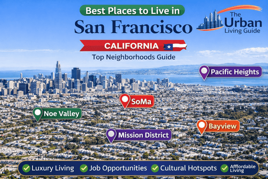
Explore Best Neighborhoods in San Francisco, California: Complete Relocation & Livability Guide in 2026
Covering a compact and topographically dramatic 46.9 square miles of land area across the northern tip of the San Francisco Peninsula, the consolidated city-county operates under the unified governance of the City and County of San Francisco[cite: 1]. Serving a resident population of approximately 808,000 to 825,000 residents within city borders and anchoring a nine-county Bay Area metropolitan footprint exceeding 7.75 million people, San Francisco is world-renowned for its iconic hills, coastal fog patterns, historic Victorian architecture, and high economic output driven by the global tech and financial sectors[cite: 1]. Relocating across this coastal metropolis demands an intricate understanding of hyper-local microclimates, street-by-street elevation changes, and multi-modal transit networks managed by the San Francisco Municipal Transportation Agency[cite: 1].
Residential living in San Francisco presents intense lifestyle and environmental variations across short distances, separating sun-drenched central valleys and vibrant cultural quarters from breezy coastal cliffs and high-density downtown tech corridors[cite: 1]. Inbound movers frequently balance immediate proximity to primary employment epicenters like the Financial District, Mission Bay Biotech Cluster, Salesforce Tower, and regional venture capital corridors against steep real estate price-per-square-foot ratios and parking constraints[cite: 1]. Deciding on a neighborhood defines your everyday transit experience across major transit lines including the Muni Metro Rail System, BART (Bay Area Rapid Transit), Caltrain commuter rail, and primary regional road passages like US Route 101 and Interstate 80 connecting across the San Francisco–Oakland Bay Bridge[cite: 1].
Watch this video to explore different neighborhoods, streetscapes, and housing styles across San Francisco:
Best Areas to Live in San Francisco at a Glance in 2026
| Neighborhood Name | Location | Distance from Core (Financial District) | Development Status | Transit Connectivity | Cost Level | Best Fit For |
|---|---|---|---|---|---|---|
| Noe Valley | Central San Francisco | Approximately 3.8 miles southwest | Historic Residential Village | High (Muni J Church Streetcar, Buses) | High-to-Premium | Families, Tech Executives & Remote Professionals |
| SoMa (South of Market) | East-Central Core | 0.5 miles south (Immediate Core) | High-Density Mixed-Use Urban | Exceptional (BART, Muni Metro, Caltrain) | Mid-to-High Range | Tech Workers, Founders & Urban Commuters |
| Pacific Heights | Northern Ridge | Approximately 2.2 miles west | Historic Ultra-Luxury Enclave | Moderate (Muni Bus Lines 1, 2, 22, 24) | Ultra-Premium | High-Net-Worth Families, Diplomats & Executives |
| Mission District | East-Central Corridor | Approximately 2.0 miles southwest | Dense Historic Cultural Quarter | Exceptional (Dual BART Stations, Muni Buses) | Mid-to-High Range | Creatives, Culinary Enthusiasts & Tech Commuters |
| Bayview | Southeastern Waterfront | Approximately 5.5 miles south | Evolving Industrial-Residential | High (Muni T Third Light Rail, US-101) | Accessible / Entry-Level | First-Time Homebuyers, Artisans & Value Seekers |
Best Neighborhoods in San Francisco Discussed in Detail
Noe Valley — Sun-Drenched Village Charm & Family-Centric Enclave
Positioned just south of the Twin Peaks ridge and sheltered from western ocean gales, Noe Valley is celebrated for enjoying some of the warmest and sunniest microclimates in San Francisco[cite: 1]. Defined by meticulously restored Victorian and Edwardian row houses, lush private gardens, and an engaged community atmosphere, the district functions around the bustling village retail spine of 24th Street[cite: 1]. Operating with municipal oversight from the San Francisco Planning Department, Noe Valley offers residential peace paired with effortless transit links into the financial core[cite: 1].
- Housing: Real estate is dominated by renovated Queen Anne Victorians, Edwardian flats, and high-end modern custom interior redesigns[cite: 1]. Single-family purchase prices typically range around $2,200,000 to $4,500,000+, while 2-bedroom rental flats average $3,800 to $5,600 per month[cite: 1].
- Safety & Crime Rate: Patrolled by the SFPD Mission Police Station and SFPD Ingleside Station, Noe Valley consistently posts among the lowest violent and property crime rates in the city, providing a safe, neighborhood-focused street environment[cite: 1].
- School District & Education Quality: Governed by the San Francisco Unified School District (SFUSD), home to sought-after neighborhood institutions including Alvarado Elementary School (featuring Spanish dual-immersion pathways) and nearby James Lick Middle School, complemented by prominent private institutions like St. Philip School[cite: 1].
- Walkability & Daily Conveniences: Outstanding pedestrian infrastructure along 24th Street between Church Street and Castro Street, offering organic markets like Whole Foods Market, independent bakeries, children’s boutiques, and artisanal coffee roasters[cite: 1].
- Parks & Green Spaces / Pet-Friendliness: Exceptional access to open recreational spaces including the Noe Valley Town Square on 24th Street, Upper Noe Recreation Center (featuring indoor gymnasiums, sports fields, and a dedicated dog run), and sweeping hill vistas from nearby Douglass Park[cite: 1].
- Parking & Traffic Congestion: Street parking is manageable compared to denser central districts, with residential permit parking zones enforced[cite: 1]. Morning commuter congestion builds primarily along Clipper Street and Dolores Street heading towards downtown arterials[cite: 1].
- Noise Levels & Vibe: Exceptionally tranquil, family-oriented, and quiet during evening hours, with pleasant daytime sidewalk foot traffic[cite: 1].
- Medical Facilities & Hospitals: Direct 8-minute vehicular access to the extensive academic and emergency trauma facilities at UCSF Helen Diller Medical Center at Parnassus Heights and Zuckerberg San Francisco General Hospital[cite: 1].
- Transit Connectivity: Direct public transit service provided by the historic streetcars of the Muni J Church Line running straight through Dolores Park into the Market Street subway, supported by Muni Bus Lines 24 and 48, alongside designated stops for regional corporate tech shuttles[cite: 1].
- Affordability: Premium price structure across real estate purchases, property taxes, and local artisan retail goods[cite: 1].
- Who It’s Best For: Growing families, corporate executives, venture capital partners, and remote professionals seeking safety, top elementary schools, and dependable sunshine[cite: 1].
- Drawbacks: High price-per-square-foot entry barrier, limited nightlife options, and steep residential hills surrounding the outer valley perimeters[cite: 1].
SoMa (South of Market) — Tech Innovation Epicenter & Modern Urban Core
Covering an expansive urban grid stretching south of Market Street to Mission Creek, SoMa (South of Market) represents San Francisco’s dynamic technological, commercial, and cultural hub[cite: 1]. Transforming historic industrial warehouses into contemporary residential lofts and glass skyscraper towers, SoMa contains micro-enclaves like Yerba Buena, South Beach, and the Design District[cite: 1]. Guided by transit-oriented development frameworks through the San Francisco Municipal Transportation Agency (SFMTA), SoMa delivers fast-paced vertical urban living[cite: 1].
- Housing: Real estate stock features luxury high-rise condominium towers (such as The Infinity and Luminary), converted industrial brick-and-timber lofts, and contemporary mid-rise apartment buildings[cite: 1]. Condominium sale prices typically range around $680,000 to $1,850,000+, while 1-bedroom modern rental units average $2,600 to $3,950 per month[cite: 1].
- Safety & Crime Rate: Patrolled by the SFPD Southern Police Station[cite: 1]. Safety profiles vary drastically by micro-block; while the South Beach waterfront and Yerba Buena cultural zones are well-patrolled, streets bordering the 6th Street corridor experience elevated rates of street-level vagrancy and property-related incidents[cite: 1].
- School District & Education Quality: Governed by SFUSD, containing specialized options such as Bessie Carmichael School (Filipino Foreign Language Immersion), with broader higher-education footprints anchored by the University of California, San Francisco (UCSF) Mission Bay Campus[cite: 1].
- Walkability & Daily Conveniences: Walk Score routinely exceeds 95/100[cite: 1]. Residents enjoy immediate walking access to essential retail including Trader Joe’s on 9th Street, Target, world-class cultural institutions like the San Francisco Museum of Modern Art (SFMOMA), and major sporting venues like Oracle Park (home of the SF Giants) and Chase Center (Golden State Warriors)[cite: 1].
- Parks & Green Spaces / Pet-Friendliness: Manicured public open spaces include the rooftop gardens of Salesforce Park, Yerba Buena Gardens, and the bayside promenade along The Embarcadero[cite: 1]. Buildings are heavily pet-friendly with dedicated private indoor dog runs[cite: 1].
- Parking & Traffic Congestion: Deeded or leased garage parking in residential towers costs an additional $250 to $450 per month per space[cite: 1]. Direct access to the on-ramps of Interstate 80 and US-101 causes localized gridlock during peak evening commute hours[cite: 1].
- Noise Levels & Vibe: Vibrant, high-energy, and modern, characterized by construction activity, emergency vehicle sirens, tech shuttle logistics, and bustling event day crowds[cite: 1].
- Medical Facilities & Hospitals: Served directly by world-class specialty care at the UCSF Medical Center at Mission Bay and urgent care clinics across the Market Street corridor[cite: 1].
- Transit Connectivity: Unrivaled multi-modal transportation network: immediate pedestrian access to BART / Muni Metro stations along Market Street (Powell, Montgomery, Civic Center), light rail via the Central Subway (T Third Line), and commuter trains at the San Francisco Caltrain Station on 4th & King[cite: 1]. Regional aviation is accessible via San Francisco International Airport (SFO) located 12 miles south[cite: 1].
- Affordability: Mid-to-high urban pricing; high monthly condominium HOA dues offset competitive price-per-square-foot metrics on modern residential high-rises[cite: 1].
- Who It’s Best For: Software engineers, tech founders, finance professionals, venture capital analysts, and Silicon Valley commuters utilizing Caltrain[cite: 1].
- Drawbacks: Prominent street-level social disparities along certain interior avenues, lack of traditional neighborhood tree canopies, and high vehicle storage fees[cite: 1].
Pacific Heights — Historic Architectural Grandeur & Panoramic Bay Overlooks
Perched high on a scenic ridge overlooking San Francisco Bay, Alcatraz Island, and the Golden Gate Bridge, Pacific Heights represents one of the most affluent and prestigious residential addresses in the world[cite: 1]. Featuring grand Victorian mansions along “Billionaire’s Row” (outer Broadway), elegant French Renaissance châteaux, and manicured private grounds, the neighborhood delivers classic architectural refinement[cite: 1]. The community operates under protective historical preservation overlays guided by the City and County of San Francisco[cite: 1].
- Housing: Real estate inventory consists of multi-million dollar detached historic mansions, grand architectural cooperatives, and luxury mid-rise condominiums along Jackson Street and Washington Street[cite: 1]. Detached estates typically range around $4,500,000 to $28,000,000+, while luxury boutique rentals average $3,900 to $9,500 per month[cite: 1].
- Safety & Crime Rate: Patrolled by the SFPD Northern Police Station and supported by extensive private residential security patrols, Pacific Heights boasts one of the lowest violent crime footprints in San Francisco[cite: 1].
- School District & Education Quality: Governed by SFUSD, but globally renowned for hosting premier elite independent day schools including Town School for Boys, Convent & Stuart Hall, San Francisco University High School, and Drew School[cite: 1].
- Walkability & Daily Conveniences: The commercial corridors along Fillmore Street, Upper Union Street, and California Street are pedestrian havens, featuring luxury designer boutiques, high-end grocers like Mollie Stone’s Market, and Michelin-starred dining[cite: 1].
- Parks & Green Spaces / Pet-Friendliness: Exceptional hilltop parklands include the rolling lawns of Alta Plaza Park and Lafayette Park, both providing designated off-leash dog exercise areas and sweeping panoramic city and water vistas[cite: 1].
- Parking & Traffic Congestion: Street parking is strictly regulated with 2-hour limits for non-permit holders; private residential garage spaces are standard for luxury properties[cite: 1]. Vehicular corridors like Van Ness Avenue (US-101) experience steady daytime traffic[cite: 1].
- Noise Levels & Vibe: Exceptionally quiet, refined, and private, with minimal ambient noise apart from bustling retail hours on Fillmore Street[cite: 1].
- Medical Facilities & Hospitals: Direct proximity to comprehensive medical care at the Sutter Health CPMC Van Ness Campus, located just minutes to the east on Geary Boulevard[cite: 1].
- Transit Connectivity: Road travel connects quickly via Lombard Street and Franklin Street; public transit options include high-frequency trolley buses like Muni Lines 1 California, 22 Fillmore, and 3 Jackson[cite: 1].
- Affordability: Ultra-premium price levels across real estate, insurance, and high-end neighborhood retail[cite: 1].
- Who It’s Best For: High-net-worth families, established corporate executives, global diplomats, and buyers seeking architectural pedigree, security, and world-class views[cite: 1].
- Drawbacks: Substantial capital requirements for property acquisitions, strict historical building renovation codes, and steep hill gradients on north-south cross streets[cite: 1].
Mission District — Cultural Hub, Vibrant Street Art & Culinary Magnet
San Francisco’s oldest neighborhood, the Mission District, is an energetic cultural corridor blending deep Latino heritage with modern technological revitalization[cite: 1]. Named after Mission San Francisco de Asís (Mission Dolores) founded in 1776, this sun-sheltered district is characterized by world-famous street murals along Clarion Alley and Balmy Alley, celebrated taquerias, and innovative culinary dining along Valencia Street and Mission Street[cite: 1]. The community is anchored by vibrant public spaces and continuous community organizing supported through SF Municipal Services[cite: 1].
- Housing: Architectural inventory encompasses classic Italianate Victorian flats, Edwardian multi-unit buildings, converted artist lofts, and sleek infill condominium developments[cite: 1]. Condominium sale prices typically range around $750,000 to $1,550,000, while apartment rentals average $2,450 to $3,800 per month[cite: 1].
- Safety & Crime Rate: Monitored by the SFPD Mission Police Station[cite: 1]. The area presents contrasting safety zones: while the western corridor near Valencia and Dolores Streets is active and safe, blocks along lower Mission Street and near the transit plazas experience property crimes and street-level disturbances[cite: 1].
- School District & Education Quality: Governed by SFUSD, containing neighborhood options like César Chávez Elementary School and Mission High School[cite: 1].
- Walkability & Daily Conveniences: Outstanding walkability (Walk Score of 98/100)[cite: 1]. Residents comfortably walk to fresh produce markets, bakeries, indie bookshops, and hundreds of dining venues, with quick access to the historic Ferry Building Marketplace via direct transit down Market Street[cite: 1].
- Parks & Green Spaces / Pet-Friendliness: Anchored by the world-famous 16-acre Mission Dolores Park, which serves as the city’s social lawn for sunbathing, picnicking, tennis, and off-leash dog recreation[cite: 1].
- Parking & Traffic Congestion: Street parking is notoriously difficult and tightly contested throughout the week[cite: 1]. Valencia Street features protected bicycle lanes, while vehicular traffic slows during peak dining hours[cite: 1].
- Noise Levels & Vibe: Vibrant, energetic, and culturally expressive, with continuous ambient street music, nightlife chatter, and active sidewalk foot traffic[cite: 1].
- Medical Facilities & Hospitals: Direct emergency medical coverage provided by Zuckerberg San Francisco General Hospital and Trauma Center on Potrero Avenue[cite: 1].
- Transit Connectivity: Outstanding regional connectivity anchored by dual subterranean BART Stations (16th St Mission and 24th St Mission), delivering a 7-minute ride to Downtown San Francisco, alongside major bus corridors including Muni Lines 14, 22, 33, and 49[cite: 1].
- Affordability: Mid-range to high; rental rates offer relative savings compared to Pacific Heights or Marina, though price-per-square-foot metrics remain elevated[cite: 1].
- Who It’s Best For: Young tech workers, culinary enthusiasts, artists, remote creatives, and urbanites seeking sunny weather and cultural vibrancy[cite: 1].
- Drawbacks: Acute street parking shortages, elevated nighttime street noise along major transit corridors, and property crime near commercial intersections[cite: 1].
Bayview — Evolving Waterfront Basin, Industrial Craft & Accessible Values
Located along the southeastern waterfront facing the calm waters of the Bay, Bayview (historically Bayview-Hunters Point) is one of San Francisco’s most culturally historic and rapidly evolving neighborhoods[cite: 1]. Known for having the highest concentration of sunny days in the city and sweeping vistas of the water, Bayview features a mix of historic single-family cottages, industrial artisan maker spaces, and emerging multi-family communities along 3rd Street[cite: 1]. The district is currently benefiting from extensive civic revitalization initiatives overseen by the San Francisco Office of Economic and Workforce Development (OEWD)[cite: 1].
- Housing: Real estate stock is dominated by detached single-story mid-century starter homes, Victorian cottages, and modern infill townhome developments[cite: 1]. Single-family purchase prices typically range around $720,000 to $1,150,000, while rental homes and flats average $1,850 to $2,850 per month[cite: 1].
- Safety & Crime Rate: Patrolled by the SFPD Bayview Police Station[cite: 1]. While the neighborhood continues to experience higher property and violent crime rates than northern city sectors, sustained community initiatives and economic investments continue to stabilize residential corridors[cite: 1].
- School District & Education Quality: Governed by SFUSD, hosting local facilities such as Dr. George Washington Carver Elementary School and Malcolm X Academy, alongside charter programs[cite: 1].
- Walkability & Daily Conveniences: Moderate walkability concentrated around 3rd Street and Palou Avenue, home to local soul food cafes, craft breweries, community grocers, and the historic Bayview Opera House[cite: 1].
- Parks & Green Spaces / Pet-Friendliness: Outstanding natural open acreage including Candlestick Point State Recreation Area (offering windsurfing, hiking, and fishing along the shoreline), Bayview Park on the hilltop, and Heron’s Head Park (an essential bird-watching wetlands sanctuary)[cite: 1].
- Parking & Traffic Congestion: Ample residential street parking and private driveways, making vehicle ownership stress-free compared to central San Francisco[cite: 1]. Easy access to US-101 and Interstate 280 minimizes highway travel times[cite: 1].
- Noise Levels & Vibe: Community-focused, creative, and relaxed, with quiet residential side streets shifting to light industrial logistics along commercial corridors[cite: 1].
- Medical Facilities & Hospitals: Direct medical care is supported by the Southeast Health Center on Keith Street and nearby trauma facilities at Zuckerberg San Francisco General Hospital[cite: 1].
- Transit Connectivity: Direct light rail transit via the Muni T Third Line running continuously along 3rd Street into Mission Bay, SoMa, and the central subway network, with immediate highway on-ramps to US-101[cite: 1].
- Affordability: San Francisco’s most accessible homeownership and rental price tier, offering substantial lot sizes and interior square footage per dollar[cite: 1].
- Who It’s Best For: First-time homebuyers, craft artisans, industrial entrepreneurs, and buyers seeking long-term equity growth in a sunny waterfront district[cite: 1].
- Drawbacks: Pockets of higher property and street crime, fewer high-end retail options within walking distance, and ongoing redevelopment transitions[cite: 1].
Comprehensive Neighborhood Pros and Cons Comparison
| Neighborhood | Core Advantages (Pros) | Core Limitations (Cons) |
|---|---|---|
| Noe Valley | Warm microclimate with abundant sunshine; exceptionally safe streets; top-tier elementary schools; charming village retail on 24th Street[cite: 1]. | High entry purchase pricing; scarce single-family rental inventory; limited late-night dining and nightlife[cite: 1]. |
| SoMa (South of Market) | Central multi-modal transit (BART, Muni, Caltrain); luxury high-rise amenities; walking access to tech corporate offices and sports stadiums[cite: 1]. | Elevated monthly parking fees; visible street-level social disparities in specific blocks; higher ambient urban noise[cite: 1]. |
| Pacific Heights | World-renowned architecture; panoramic views of San Francisco Bay; top independent schools; premier safety and private security[cite: 1]. | Ultra-premium real estate valuations; strict historical zoning codes; steep street gradients requiring personal vehicle travel[cite: 1]. |
| Mission District | Sunny weather; vibrant cultural arts scene; direct dual-station BART transit; world-class culinary options along Valencia Street[cite: 1]. | Acute shortage of residential and guest parking; higher street noise; property crime concerns near commercial hubs[cite: 1]. |
| Bayview | Most attainable home purchase pricing in the city; sunny microclimate; generous detached home lot sizes; direct Muni T Line rail[cite: 1]. | Pockets of elevated property crime; fewer walkable daily retail conveniences; ongoing industrial transition zones[cite: 1]. |
How You Decide Which Neighborhood Is Best For You
Choosing your ideal neighborhood in San Francisco requires aligning your gross household budget with day-to-day transit logistics, microclimate comfort, and utility infrastructure reliability[cite: 1]. Because San Francisco spans distinct topographical hills that trap oceanic fog banks, your location dictates whether you experience foggy conditions in western neighborhoods or daily sunshine in protected central and eastern enclaves like Noe Valley and the Mission District[cite: 1]. Commuters traveling southward to Silicon Valley campuses should prioritize quick access to the San Francisco Caltrain Station on 4th & King or the Interstate 280 freeway corridor to bypass congested surface streets[cite: 1].
Beyond transportation routes, evaluate essential municipal infrastructure realities such as electrical grid stability, internet connectivity, and building maintenance[cite: 1]. Historic Victorian and Edwardian buildings often require careful inspection for updated electrical panels, seismic retrofitting, and high-speed fiber broadband availability (such as Sonic Fiber, Monkeybrains, or AT&T Fiber)[cite: 1]. Ensure you verify assigned off-street garage parking spaces—a critical asset that can save hundreds of dollars each month and hours of street sweeping avoidance—before finalizing a residential lease or property purchase[cite: 1].
Frequently Asked Questions About San Francisco Neighborhoods
Which neighborhood in San Francisco is best for families with children?
Noe Valley is widely considered the top choice for families due to its sunny microclimate, exceptionally low crime rates, stroller-friendly sidewalks, community parks like Upper Noe Recreation Center, and top-performing elementary schools within SFUSD[cite: 1].
What is the most walkable neighborhood in San Francisco where you can live comfortably without a car?
The Mission District and SoMa (South of Market) offer the highest walkability scores in the city, frequently scoring 95+ out of 100[cite: 1]. Both areas provide immediate walking access to grocery markets, dining, and multi-modal transit options including subterranean BART stations, Muni light rail, and Caltrain commuter rail[cite: 1].
What are the safest residential neighborhoods to live in San Francisco?
Pacific Heights and Noe Valley consistently report some of the lowest violent crime numbers in the city[cite: 1]. Pacific Heights benefits from active private residential patrols and affluent residential tranquility, while Noe Valley maintains strong community vigilance and calm side streets[cite: 1].
What are the most affordable neighborhoods for homebuyers and renters in San Francisco?
Bayview and parts of the Outer Mission / Excelsior corridors provide the most accessible entry-level price points in the city[cite: 1]. In Bayview, buyers and renters can secure detached single-family homes and spacious apartments at pricing significantly lower than northern or central neighborhoods[cite: 1].
How much do weather and fog vary across different San Francisco neighborhoods?
Microclimates vary dramatically across San Francisco’s hills[cite: 1]. Eastern and central valley neighborhoods like the Mission District, Noe Valley, and Bayview enjoy frequent sunshine and warmer temperatures, while western coastal neighborhoods near Ocean Beach often experience heavy Pacific fog and cooler marine winds[cite: 1].
How difficult is street parking in San Francisco neighborhoods?
Street parking is notoriously difficult in dense neighborhoods like the Mission District and SoMa due to limited street spaces, strict meter enforcement, and bi-weekly street sweeping schedules[cite: 1]. Conversely, southern and suburban-style neighborhoods like Bayview offer much more accessible on-street and driveway parking[cite: 1].
Which neighborhood offers the fastest commute to Silicon Valley tech campuses?
SoMa and Mission Bay offer the most convenient access for Silicon Valley tech workers, providing walking access to the 4th & King Caltrain Station, express highway on-ramps to I-280, and numerous regional tech company shuttle pickup hubs[cite: 1].
Know More About the City
The Urban Living Guide creates deeply researched, practical, and informative city relocation resources designed to help individuals, working professionals, and families navigate complex urban landscapes[cite: 1]. By analyzing municipal infrastructure, hyper-local zoning patterns, commuter realities, and housing markets, our guides provide actionable insights so you can make confident, data-backed decisions when moving to major metropolitan areas[cite: 1].
Explore our comprehensive guides to the San Francisco metropolitan region:
- Living in San Francisco, California
- Cost of Living in San Francisco, California
- Pros and Cons of Living in San Francisco, California
- Moving to San Francisco, California
Follow The Urban Living Guide for ongoing regional insights, neighborhood developments, and expert local coverage across Northern California and the Bay Area