

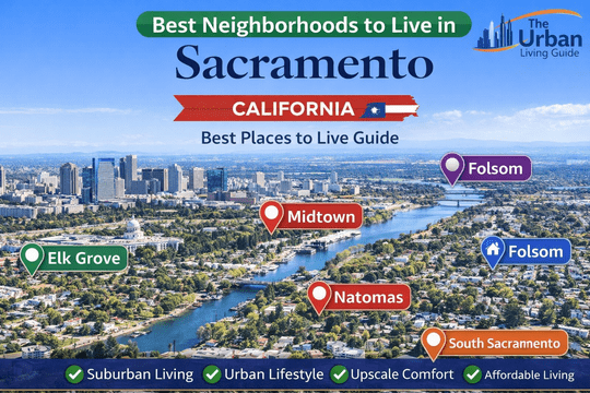
Best Neighborhoods in Sacramento, California: Capital Living, Top Suburbs & River City Pockets in 2026
Covering approximately 98.6 square miles of land area at the confluence of the Sacramento and American Rivers, California’s state capital functions under the municipal administration of the City of Sacramento within the broader governance of Sacramento County. Housing a municipal core population of approximately 525,000 residents and anchoring a growing regional metropolitan footprint exceeding 2.42 million people, the region offers an established urban tree canopy, historic legislative centers, and master-planned suburban expansions. Relocating to the “City of Trees” requires evaluating localized micro-pockets, regional flood protection infrastructure, summer Central Valley heat corridors, and major highway systems managed by the California Department of Transportation.
Residential distribution across Greater Sacramento creates distinct lifestyle contrasts, separating walkable historic grid districts and dynamic cultural corridors from quiet foothill lake communities and expansive agricultural riverfront basins. Inbound movers frequently balance rapid access to state government complexes, the expanding UC Davis Health Medical Campus, and regional tech operations against commute bottlenecks along major transit arteries including Interstate 80, US Route 50 (El Dorado Freeway), State Route 99, and Interstate 5. Choosing the right neighborhood determines your everyday proximity to light rail corridors, regional greenbelts like the American River Parkway, and top-tier public school districts.
Watch this video to explore different neighborhoods, suburban corridors, and residential communities across Sacramento:
Best Areas to Live in Sacramento at a Glance in 2026
| Neighborhood Name | Location | Distance from Core (Downtown) | Development Status | Transit Connectivity | Cost Level | Best Fit For |
|---|---|---|---|---|---|---|
| Elk Grove | South Sacramento County (Incorporated) | Approximately 15 miles south | Master-Planned Suburban | Moderate (e-tran Commuter Buses, SR-99, I-5) | Mid-Range | Growing Families & State Workers |
| Midtown | Central City Grid | Approximately 1 mile east | Historic Walkable Urban | Exceptional (SacRT Light Rail, Bike Grids) | Mid-to-High Range | Young Professionals, Creatives & Foodies |
| Folsom | Eastern Foothills (Incorporated) | Approximately 22 miles east | Upscale Suburban / Tech Hub | Moderate (SacRT Gold Line, US-50) | High-to-Premium | Tech Professionals, Outdoor Enthusiasts & Families |
| Natomas (North & South) | Northwest Basin | Approximately 5 miles north | Modern Master-Planned Infill | High (I-5, I-80, SMF Airport Express) | Mid-Range | Airport Commuters, Remote Staff & Buyers |
| South Sacramento | South Central Basin | Approximately 7 miles south | Established Diverse Suburban | High (SacRT Blue Line Light Rail, SR-99) | Accessible / Budget-Friendly | Value Renters & First-Time Homebuyers |
Best Neighborhoods in Sacramento Discussed in Detail
Elk Grove — Family-Focused Master-Planned Haven & Educational Center
Situated directly south of the city limits, Elk Grove is a thriving incorporated municipality that has transformed from an agricultural farming community into one of Northern California’s premier family hubs. Administered independently through the City of Elk Grove Official Portal, the city is characterized by planned residential villages such as Laguna West, East Elk Grove, and the developing SEPA (Southeast Policy Area). Known for expansive municipal parks, wide tree-lined parkways, and low crime rates, Elk Grove offers a secure suburban setting with extensive retail commercial centers.
- Housing: Real estate is dominated by contemporary single-family tract homes, spacious two-story Mediterranean-style residences, and modern gated townhome developments. Single-family purchase prices typically range around $580,000 to $875,000, while rental homes and apartments average $2,100 to $3,200 per month.
- Safety & Crime Rate: Patrolled by the dedicated Elk Grove Police Department (EGPD), the community maintains one of the lowest violent and property crime rates in Greater Sacramento, supported by proactive neighborhood watch groups.
- School District & Education Quality: Governed by the highly regarded Elk Grove Unified School District (EGUSD), the fifth-largest school district in California, hosting top-performing public institutions such as Pleasant Grove High School, Franklin High School, and Cosumnes River College.
- Walkability & Daily Conveniences: Interior subdivisions are automobile-dependent, but pedestrian-friendly retail corridors exist along Elk Grove Boulevard and Laguna Boulevard, anchored by major supermarkets, boutique eateries, and the historic Old Town Elk Grove strip.
- Parks & Green Spaces / Pet-Friendliness: Exceptional municipal recreation managed by the Cosumnes Community Services District (CSD), featuring Elk Grove Regional Park, Oasis Community Park, and extensive multi-use paths linking to the Cosumnes River Preserve.
- Parking & Traffic Congestion: Ample residential driveways, two-to-three car garages, and wide street parking. Commuter slowdowns are frequent along northbound State Route 99 and Interstate 5 during morning commutes into Downtown Sacramento.
- Noise Levels & Vibe: Serene, quiet, and family-oriented, with strictly enforced residential sound ordinances and tranquil evening cul-de-sacs.
- Medical Facilities & Hospitals: Direct medical infrastructure supported by the Kaiser Permanente Elk Grove Medical Offices and Sutter Health Elk Grove Care Center, with full trauma facilities 12 minutes north at Methodist Hospital of Sacramento.
- Transit Connectivity: Public transit is provided by the e-tran / SacRT commuter bus service running non-stop express routes into Downtown Sacramento, complemented by highway access via SR-99 and I-5.
- Affordability: Balanced mid-range pricing offering superior square footage and modern energy efficiency per dollar compared to the central city core.
- Who It’s Best For: Growing families prioritizing top-tier public schools, state workers willing to manage a highway commute, and buyers seeking spacious suburban floor plans.
- Drawbacks: Heavy rush-hour freeway delays along SR-99, warmer summer inland temperatures, and limited independent nightlife outside local brewpubs.
Midtown — Tree-Canopied Cultural Epicenter & Walkable Arts District
Located on the central city street grid directly east of the California State Capitol, Midtown Sacramento is the energetic cultural, culinary, and social heart of the metropolitan region. Characterized by leafy canopies of mature elm and sycamore trees, historic Victorian architecture, and modern infill apartment buildings, Midtown blends historic charm with a thriving indie arts and dining scene. The neighborhood thrives under active local collaboration led by the Midtown Association.
- Housing: Real estate stock features ornate restored 19th-century Victorian homes, Craftsman duplexes, converted brick warehouse lofts, and contemporary glass-and-steel mid-rise apartment buildings. Detached historic home prices typically range around $650,000 to $1,250,000, while modern 1-bedroom apartments average $1,850 to $2,800 per month.
- Safety & Crime Rate: Patrolled by the Sacramento Police Department Central Command. Residential side streets are pedestrian-active and safe, though non-violent property crimes such as bicycle theft and automotive break-ins occur around active nightlife zones.
- School District & Education Quality: Governed by the Sacramento City Unified School District (SCUSD), containing historic options like William Land Elementary and regional specialty campuses such as C.K. McClatchy High School.
- Walkability & Daily Conveniences: Exceptionally walkable (Walk Score of 90-94/100) and bike-friendly. Residents easily stroll to farm-to-fork dining along J Street, K Street, and the R Street Corridor, alongside the massive weekly Midtown Farmers Market.
- Parks & Green Spaces / Pet-Friendliness: Outstanding urban parklands including Sutter’s Fort State Historic Park, the peaceful flower gardens of Capitol Park, and Truitt Bark Park, one of the most active community dog parks in the city.
- Parking & Traffic Congestion: Street parking is strictly managed through city residential permits and electronic meters. Securing off-street or garage parking is recommended to avoid weekly street-sweeping citations.
- Noise Levels & Vibe: Vibrant, creative, and lively, with bustling outdoor patio dining, live music venues, and steady foot traffic during Second Saturday Art Walks.
- Medical Facilities & Hospitals: Direct emergency medical access anchored within the neighborhood by Sutter Medical Center, Sacramento on L Street and nearby Mercy General Hospital in East Sacramento.
- Transit Connectivity: Excellent public transit via the SacRT Light Rail Gold and Blue Lines crossing the central grid, supported by high-frequency bus lines and regional connections at the historic Sacramento Valley Station (Amtrak Capitol Corridor).
- Affordability: Mid-to-high urban pricing; premium rents per square foot reflect the neighborhood’s unmatched walkability and cultural appeal.
- Who It’s Best For: Legislative aides, healthcare workers at Sutter and UC Davis, remote creatives, and young professionals seeking a walkable, car-optional lifestyle.
- Drawbacks: Competitive street parking for multi-car households, higher weekend noise levels near late-night dining corridors, and smaller historic lot sizes.
Folsom — Historic Foothill Enclave, Tech Corridor & Premier Outdoor Recreation
Nestled against the Sierra Nevada foothills along the eastern edge of Sacramento County, the independent municipality of Folsom is celebrated for its outstanding standard of living, prestigious corporate tech employers, and direct access to pristine waterways. Governed through the City of Folsom Official Website, the city seamlessly merges historic Gold Rush history in Historic Sutter Street with master-planned luxury communities like Broadstone, Empire Ranch, and Folsom Ranch.
- Housing: Architectural inventory encompasses upscale contemporary single-family residences, gated executive golf communities, and luxury garden apartments. Detached property valuations typically range around $680,000 to $1,450,000+, while modern apartment rentals average $2,200 to $3,300 per month.
- Safety & Crime Rate: Monitored by the Folsom Police Department (FPD), consistently ranking as one of the safest cities in Northern California, with negligible violent crime rates and responsive emergency services.
- School District & Education Quality: Governed by the premier Folsom Cordova Unified School District (FCUSD), hosting top-ranked public schools such as Folsom High School and Vista del Lago High School, alongside higher education at Folsom Lake College.
- Walkability & Daily Conveniences: While residential neighborhoods are automobile-centric, Historic Folsom and the Palladio Outdoor Lifestyle Center provide pedestrian shopping, fine dining, cinemas, and boutique grocers like Whole Foods Market.
- Parks & Green Spaces / Pet-Friendliness: World-class outdoor infrastructure highlighted by Folsom Lake State Recreation Area, Lake Natoma (renowned for paddleboarding and rowing), and over 50 miles of paved class-I multi-use trails connecting to the American River Parkway.
- Parking & Traffic Congestion: Ample parking across private driveways and commercial retail plazas. Commuter traffic builds westward along US Route 50 during morning peak hours heading toward Downtown Sacramento.
- Noise Levels & Vibe: Peaceful, upscale, and active, dominated by outdoor recreation, cycling culture, and quiet residential evenings.
- Medical Facilities & Hospitals: Direct emergency medical coverage provided within city borders by Mercy Hospital of Folsom on Creekside Drive.
- Transit Connectivity: Direct public light rail transit via the SacRT Light Rail Gold Line terminating at the Historic Folsom Station, alongside rapid highway access via US-50.
- Affordability: High-tier pricing across home purchases, local property taxes, and dining, offset by exceptional municipal services and recreational amenities.
- Who It’s Best For: Tech professionals working at regional employers (such as Intel Folsom Campus or Micron), outdoor adventure enthusiasts, water-skiers, cyclists, and families demanding top-ranked public schools.
- Drawbacks: Higher entry home purchase pricing, hot summer foothill weather, and a 20-to-30 minute commute into the central downtown government district.
Natomas — Modern Valley Corridor, Airport Gateway & Rapidly Growing Infill
Situated in the northwestern quadrant of the city just north of the American River, Natomas (comprising North and South Natomas) represents one of Sacramento’s most dynamic master-planned suburban districts. Governed under City of Sacramento council districts, Natomas was developed primarily over the past two decades around major retail centers, community greenbelts, and regional corporate business parks along Truxel Road and Del Paso Road.
- Housing: Real estate consists of newer contemporary single-family tract homes, solar-equipped modern subdivisions, and spacious multi-family rental complexes. Single-family home prices typically range around $510,000 to $760,000, while apartment rentals average $1,900 to $2,750 per month.
- Safety & Crime Rate: Patrolled by the Sacramento Police Department North Command. Master-planned tracts in North Natomas feature strong community engagement and low crime statistics, while commercial retail areas along highway corridors experience typical property incidents.
- School District & Education Quality: Governed primarily by the Natomas Unified School District (NUSD), offering specialized public pathways such as Natomas Pacific Pathways Prep (NP3) Charter High School and Inderkum High School.
- Walkability & Daily Conveniences: Designed around commercial power centers like Natomas Marketplace and Promenade at Sacramento Gateway, providing convenient shopping at Target, home improvement centers, and casual eateries.
- Parks & Green Spaces / Pet-Friendliness: Outstanding municipal parks including the 200-acre North Natomas Regional Park (featuring dog parks, soccer fields, and a massive community water play area), alongside paved regional trails along the Barge Canal.
- Parking & Traffic Congestion: Wide residential roadways, ample driveway space, and stress-free parking across all retail centers. Traffic bottlenecks concentrate near the junction of Interstate 5 and Interstate 80 during peak commuter windows.
- Noise Levels & Vibe: Modern, relaxed, and convenient, with residential calm punctuated by occasional aviation noise from airport approach corridors.
- Medical Facilities & Hospitals: Direct outpatient healthcare via Kaiser Permanente Sleepy River Medical Offices and UC Davis Health Natomas Clinic.
- Transit Connectivity: Unrivaled highway and aviation connectivity: immediate access to the intersection of I-5 and I-80, combined with a 7-minute drive to Sacramento International Airport (SMF) and express bus links via SacRT Route 142.
- Affordability: Highly competitive mid-range price point offering modern construction, attached garages, and lower utility overhead.
- Who It’s Best For: Frequent business travelers, airport personnel, remote tech employees, and buyers seeking newer, move-in ready construction close to Downtown.
- Drawbacks: Ongoing regional levee improvement assessments, reliance on personal vehicles for daily retail errands, and summer heat in the valley basin.
South Sacramento — Historic Cultural Diversity, Urban Infill & Budget-Conscious Living
Covering an expansive geographic area south of Sutterville Road and extending along the Stockton Boulevard and Franklin Boulevard corridors, South Sacramento is one of the region’s most culturally diverse and accessible residential districts. Celebrated for its rich culinary fabric—including the vibrant Little Saigon Cultural and Commercial District—the neighborhood offers established single-story mid-century homes and direct public rail connectivity.
- Housing: Dominated by 1950s–1970s single-story California ranch homes on generous lot sizes, duplexes, and value-oriented apartment complexes. Detached property valuations typically range around $380,000 to $540,000, while apartment rentals average $1,450 to $2,100 per month.
- Safety & Crime Rate: Patrolled by the Sacramento County Sheriff’s Office and Sacramento Police Department South Command. Property crime rates and street disturbances are higher along commercial arterial strips, while established interior residential blocks maintain stable, multi-generational community ties.
- School District & Education Quality: Governed by a mix of Sacramento City Unified and Elk Grove Unified school districts, containing neighborhood options like Luther Burbank High School and Florin High School.
- Walkability & Daily Conveniences: High pedestrian accessibility along commercial centers on Stockton Boulevard, home to authentic international supermarkets like SF Supermarket, authentic pho houses, Asian bakeries, and community markets.
- Parks & Green Spaces / Pet-Friendliness: Municipal recreation is anchored by the historic 166-acre William Land Regional Park (home to the Sacramento Zoo, Fairytale Town, and golf courses) located on its northwestern border, alongside Southside Park and Pannell Community Center.
- Parking & Traffic Congestion: Generous on-street parking and private residential driveways. Direct highway access onto State Route 99 provides rapid travel, though surface arterials experience steady daytime commercial flow.
- Noise Levels & Vibe: Energetic, grounded, and multicultural, with active commercial avenues shifting to quiet suburban evenings in residential tracts.
- Medical Facilities & Hospitals: Direct access to major healthcare institutions including Kaiser Permanente South Sacramento Medical Center (featuring a Level II Trauma Center) on Bruceville Road.
- Transit Connectivity: Outstanding light rail access via the SacRT Light Rail Blue Line, providing non-stop transit service straight into Downtown Sacramento and the university campuses.
- Affordability: Sacramento’s most accessible entry-level homeownership and rental price tier, offering substantial residential acreage and interior space per dollar.
- Who It’s Best For: First-time homebuyers, culinary enthusiasts, budget-conscious renters, and commuters seeking direct light rail access to Downtown.
- Drawbacks: Elevated property crime rates near commercial boulevards, variable school district test performance across individual tracts, and aging municipal street infrastructure in unincorporated pockets.
Comprehensive Neighborhood Pros and Cons Comparison
| Neighborhood | Core Advantages (Pros) | Core Limitations (Cons) |
|---|---|---|
| Elk Grove | Top-ranked EGUSD public schools; exceptionally safe master-planned neighborhoods; extensive community parks and youth sports leagues. | Heavy rush-hour bottlenecks on SR-99 and I-5; hot summer temperatures; car dependence for daily errands. |
| Midtown | Outstanding walkability and bike networks; historic Victorian architecture; farm-to-fork dining and weekly Midtown Farmers Market; light rail access. | Strict residential parking permits; elevated weekend nightlife street noise; higher rental rates per square foot. |
| Folsom | Direct access to Folsom Lake and 50+ miles of paved cycling trails; top-rated FCUSD schools; lowest crime rates; major tech employers. | Higher entry real estate valuations; 22-mile commute to Downtown; hot summer foothill afternoons. |
| Natomas | Modern energy-efficient housing; 7-minute drive to Sacramento International Airport (SMF); easy interchange access to I-5 and I-80. | Ongoing flood basin levee tax assessments; commercial retail strips require driving; modest late-night dining options. |
| South Sacramento | Most attainable home purchase and rental pricing; rich cultural cuisine in Little Saigon; direct SacRT Blue Line light rail to Downtown. | Pockets of elevated property crime; variable school test ratings; older street infrastructure in unincorporated areas. |
How You Decide Which Neighborhood Is Best For You
Choosing your ideal neighborhood in Greater Sacramento requires aligning your monthly household finances with daily workplace locations, family schooling needs, and summer climate comfort. Because the Sacramento metropolitan area spans multiple river crossings and expansive valley terrain, your chosen neighborhood dictates whether your daily commute relies on heavily traveled highway corridors like SR-99 and US-50 or on direct light rail connections via the SacRT Gold and Blue Lines. Individuals working in state government offices or at the UC Davis Health center should prioritize central grid living in Midtown or close-in suburban access in Natomas to avoid extended highway delays.
Beyond commuter routes, evaluate essential municipal utility and environmental realities. Sacramento experiences extended summer heat waves exceeding 100 degrees Fahrenheit, making electrical grid reliability and air conditioning utility costs through the Sacramento Municipal Utility District (SMUD)—which offers significantly lower electric rates than investor-owned utilities in coastal California—a major financial advantage. Prior to finalizing a purchase contract or residential lease, verify high-speed fiber broadband availability (such as AT&T Fiber or Xfinity Gigabit), check local levee flood protection zones, and review school district boundary maps.
Frequently Asked Questions About Sacramento Neighborhoods
Which neighborhood in the Sacramento area is considered best for families?
Elk Grove and Folsom are widely considered the premier family communities in Greater Sacramento. Both cities feature top-tier public school districts (Elk Grove Unified and Folsom Cordova Unified), expansive municipal park networks with extensive youth sports facilities, and low violent crime rates.
What is the most walkable neighborhood in Sacramento where you can live without a car?
Midtown Sacramento is the most walkable and bike-friendly neighborhood in the region, boasting a 90+ Walk Score. Residents can easily accomplish daily errands on foot, walk to local grocery markets and farm-to-fork dining, and connect directly to the SacRT Light Rail network.
What are the safest residential neighborhoods in Greater Sacramento?
Folsom and Elk Grove consistently report the lowest property and violent crime rates in the metropolitan area. Both incorporated cities maintain independent municipal police departments with fast emergency response times and active community policing.
What are the most affordable neighborhoods for homebuyers and renters in Sacramento?
South Sacramento and parts of North Sacramento provide the most budget-friendly housing alternatives, offering detached single-family starter homes and rental apartments at price points substantially lower than eastern suburbs or the central urban grid.
How hot does it get in Sacramento during the summer months?
Sacramento experiences a Mediterranean Central Valley climate with hot, dry summers. High temperatures routinely exceed 90 to 100 degrees Fahrenheit from June through September, though evenings frequently benefit from the cooling “Delta Breeze” blowing inland from the San Francisco Bay.
Is public transportation dependable for commuting to Downtown Sacramento?
Yes, the SacRT Light Rail system (Gold and Blue Lines) provides reliable commuter rail service connecting Downtown from Folsom, Rancho Cordova, and South Sacramento, while express commuter bus routes link Elk Grove and Natomas directly to state office complexes.
Which Sacramento neighborhood is best for tech workers and outdoor enthusiasts?
Folsom is the leading choice for tech professionals and outdoor lovers, offering direct proximity to major tech employers like Intel, alongside immediate access to Lake Natoma, Folsom Lake, and the 32-mile American River Parkway bike trail.
Know More About the City
The Urban Living Guide creates deeply researched, practical, and informative city relocation resources designed to help individuals, working professionals, and families navigate complex urban landscapes. By analyzing municipal infrastructure, hyper-local zoning patterns, commuter realities, and housing markets, our guides provide actionable insights so you can make confident, data-backed decisions when moving to major metropolitan areas.
Explore our comprehensive guides to the Sacramento metropolitan region:
- Living in Sacramento, California
- Cost of Living in Sacramento, California
- Pros and Cons of Living in Sacramento, California
- Moving to Sacramento, California
Follow The Urban Living Guide for ongoing regional insights, neighborhood developments, and expert local coverage across Greater Sacramento and Northern California.